Category Archives: Barrow Walk (2017)

Day 6: Clashganny to St. Mullins (13km)

Clashganny on the Barrow River

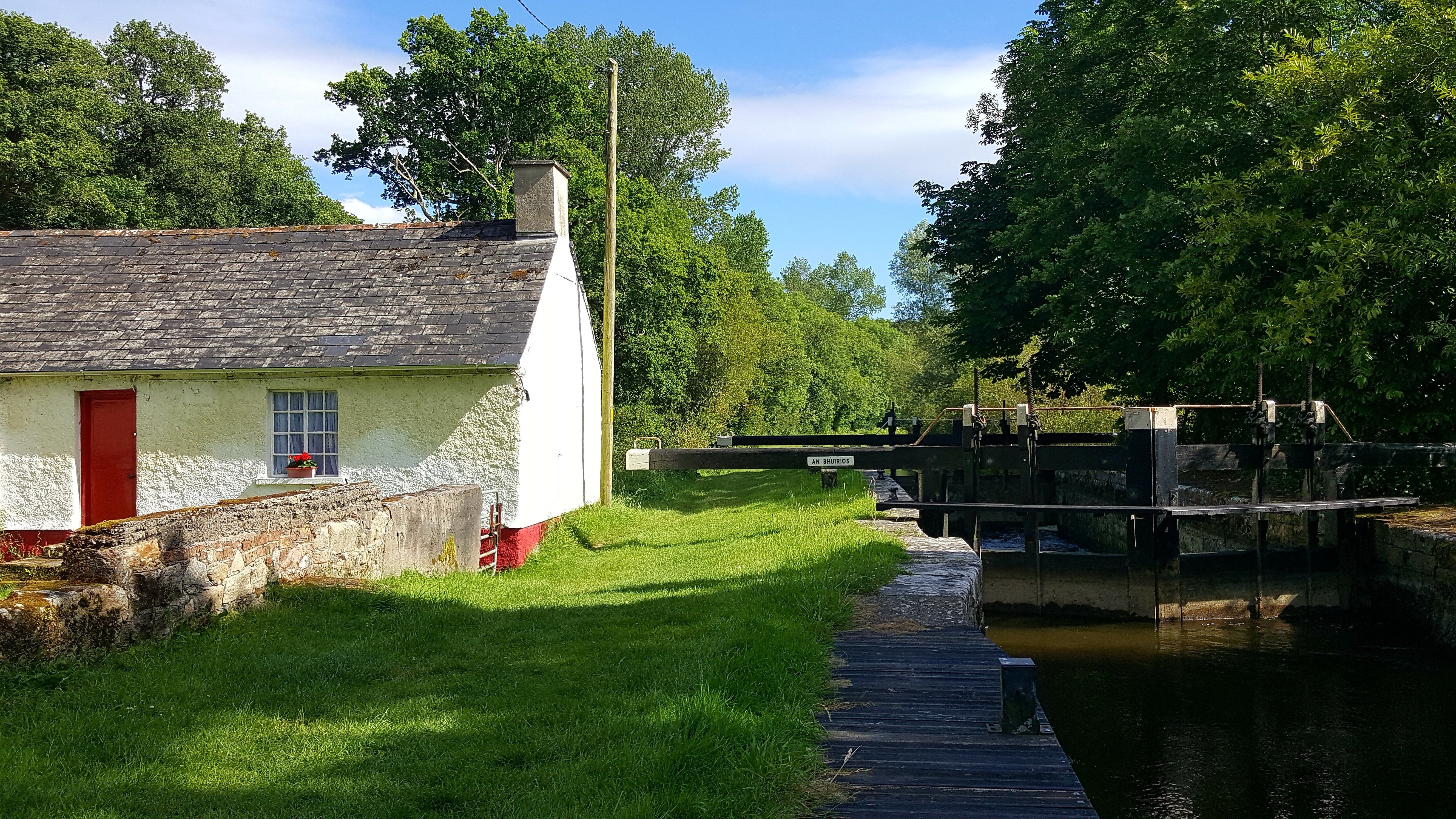
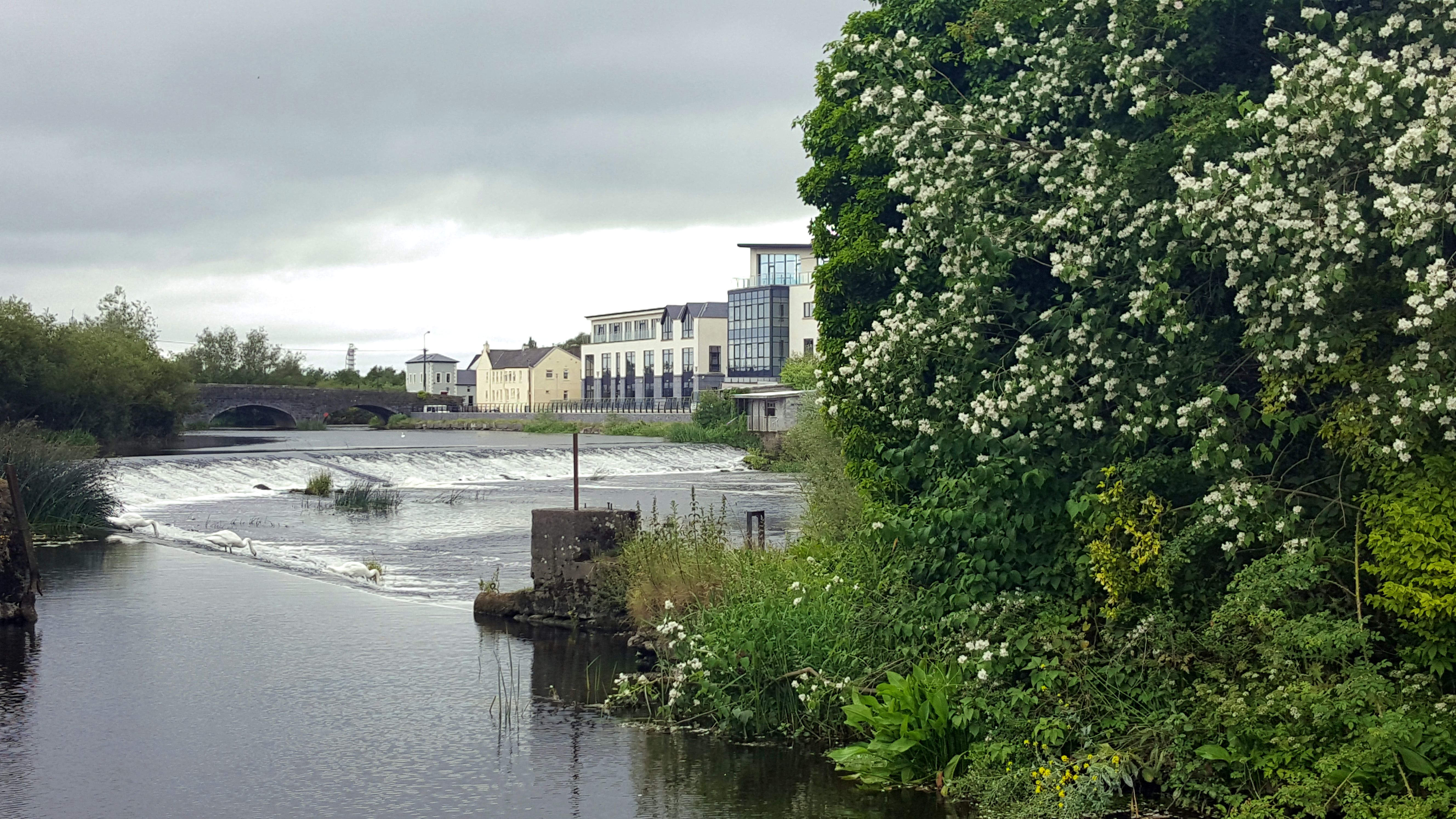
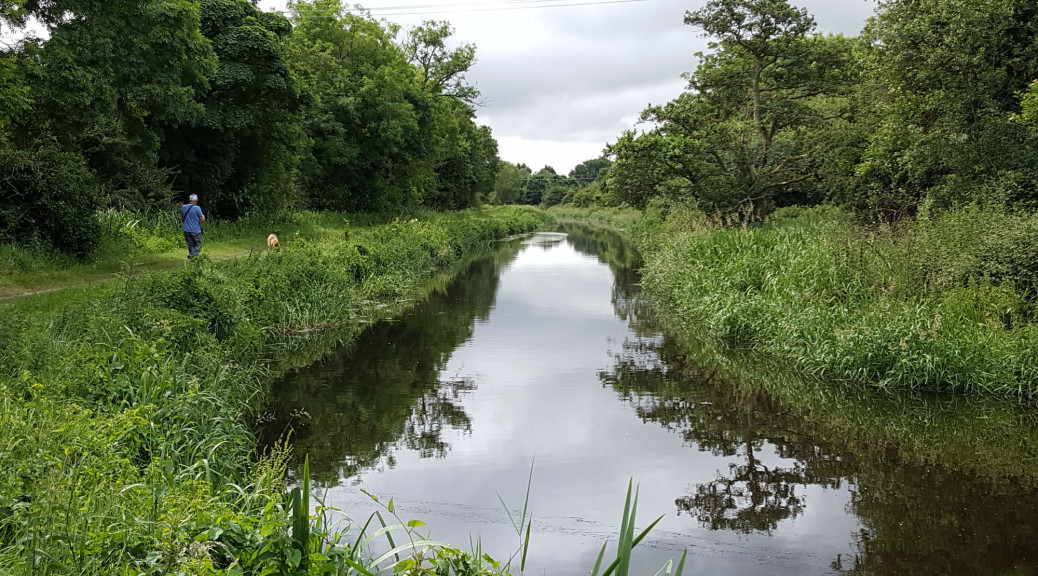
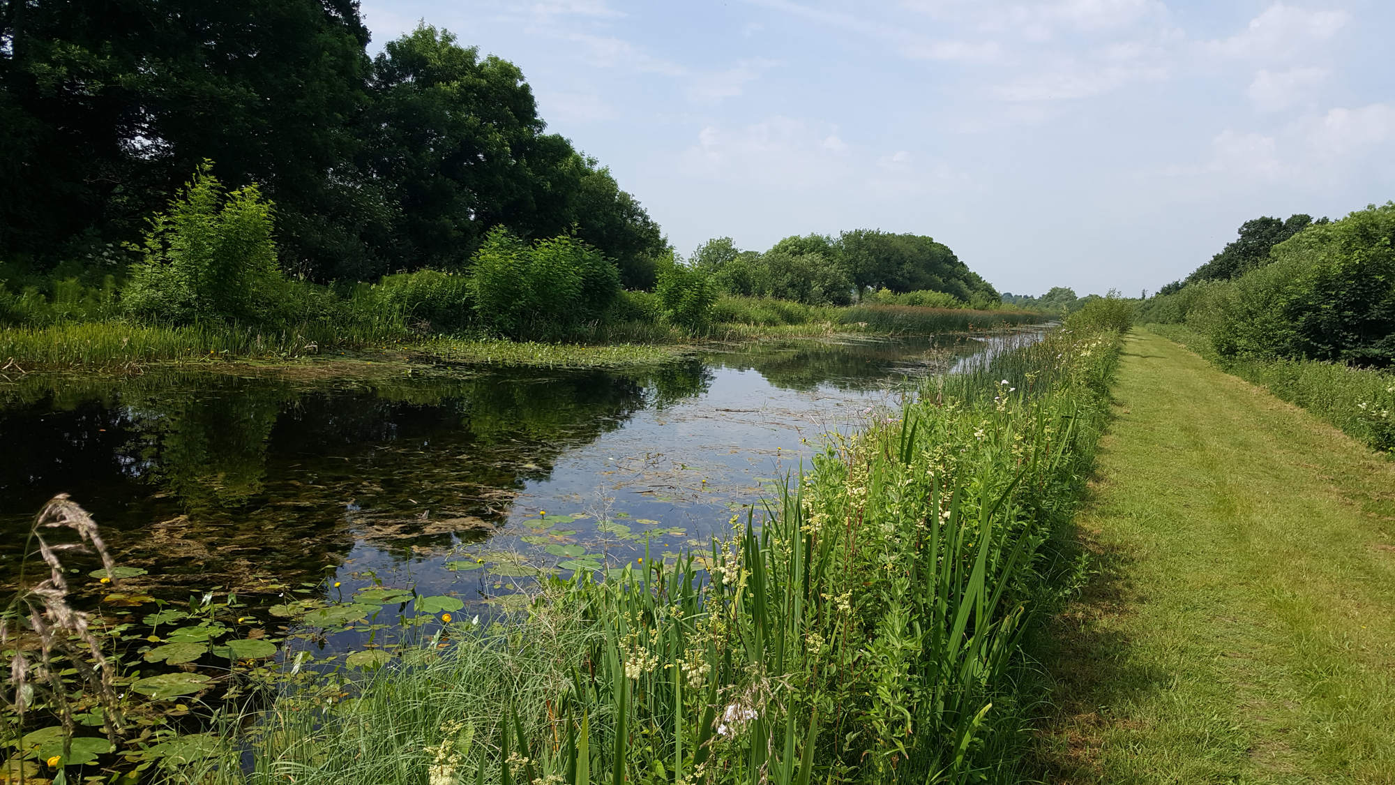
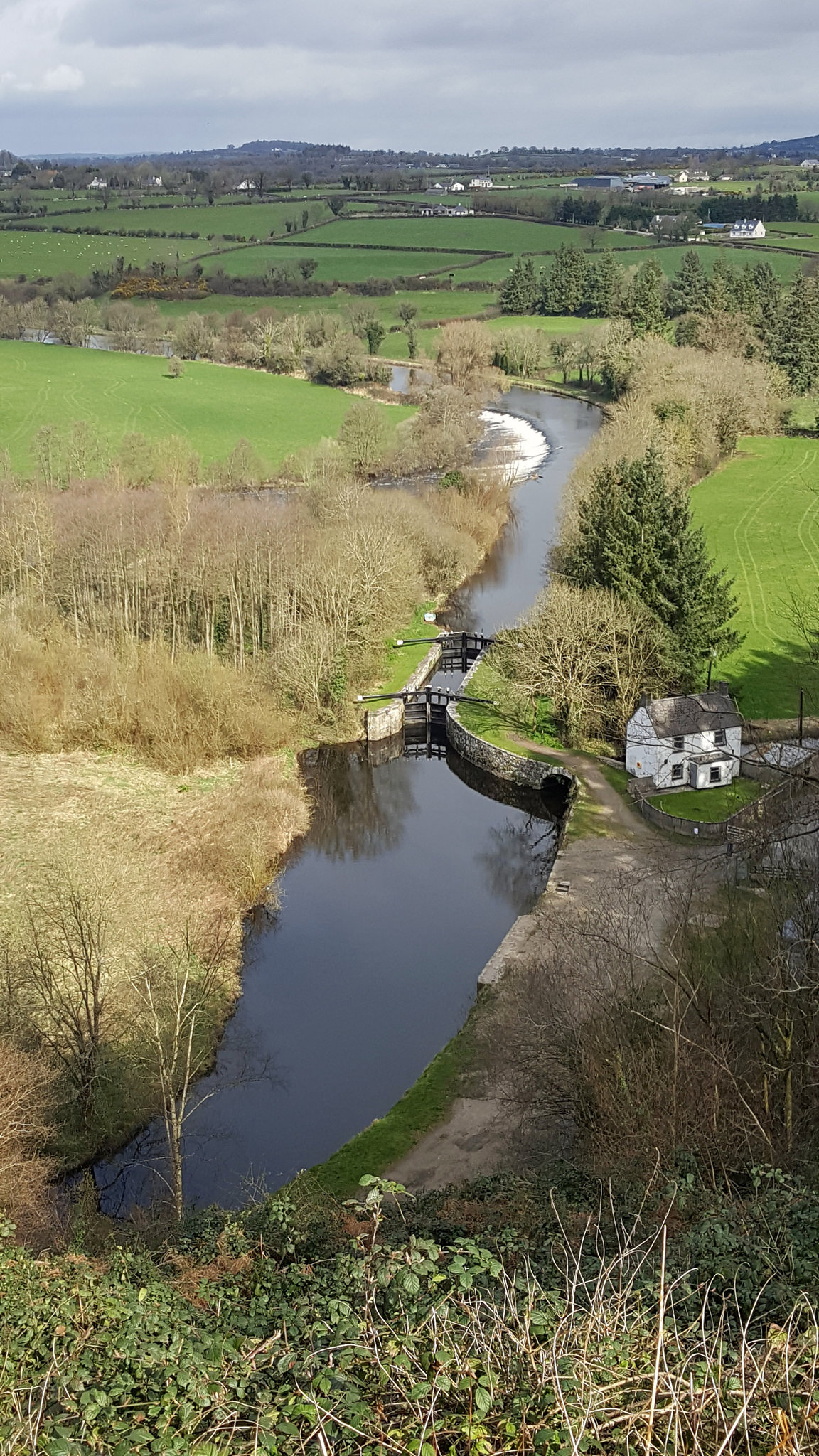
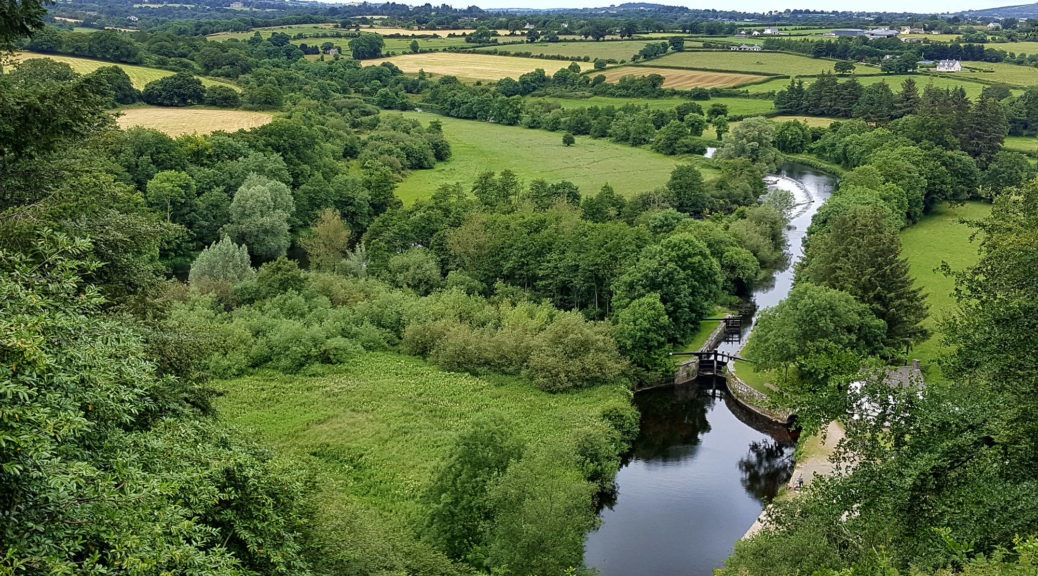
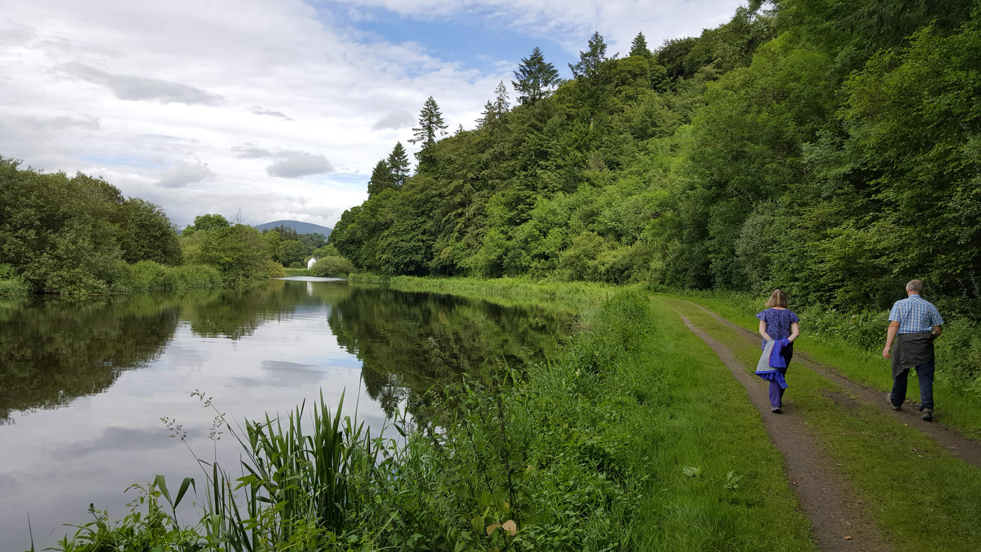
Day 6 was a fairly short final section of the Barrow Towpath from Clashganny to St. Mullins, a distance of 13km. Clashganny is another lock gate in a picturesque setting, but it differs from the others as excellent facilities have been provided here for users of the river. Lifeguards are on duty for the summer months, and there is a block of newly developed changing rooms and toilets for the visitors. Consequently, the area is a popular site for day trippers, and campers over the summer weekends. When I arrived mid-afternoon of a Sunday, the area was quiet again, but a smouldering fire and way too many empty alcohol bottles strew about, suggesting that it was not so quiet into the early hours of the previous night.

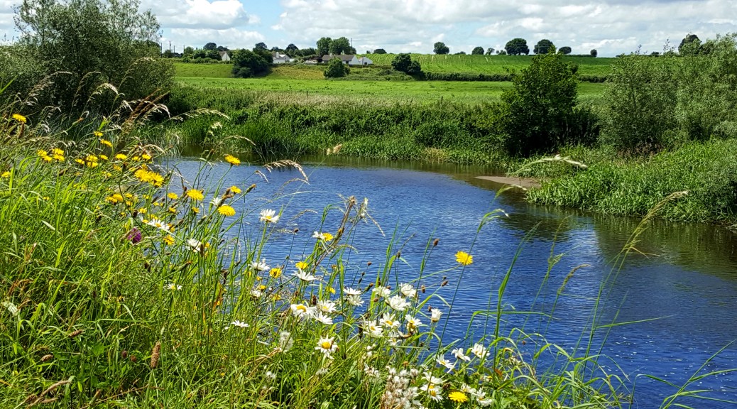
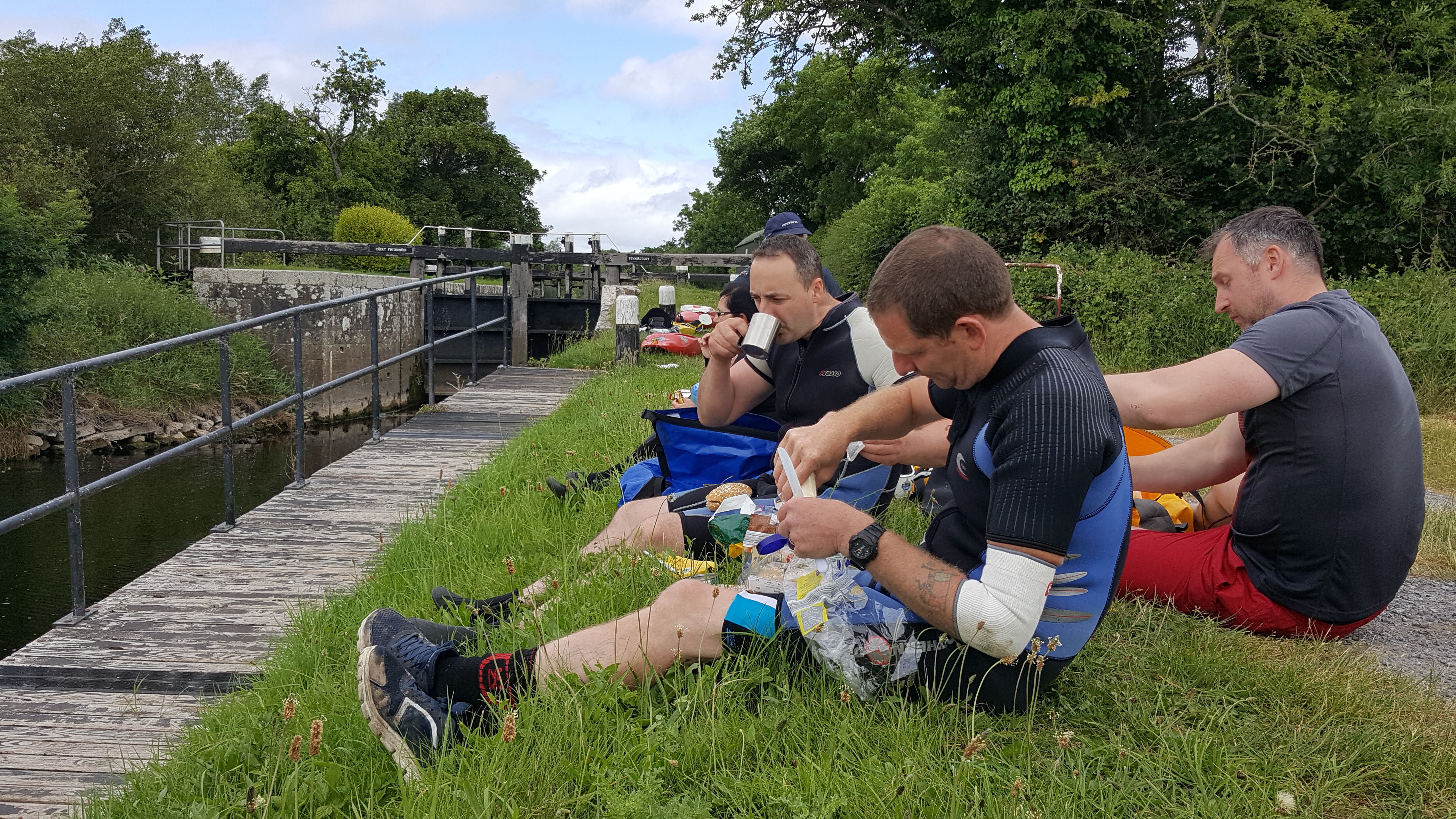
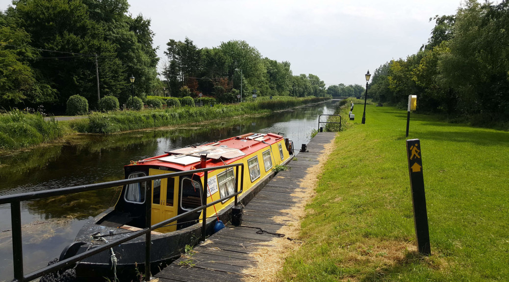
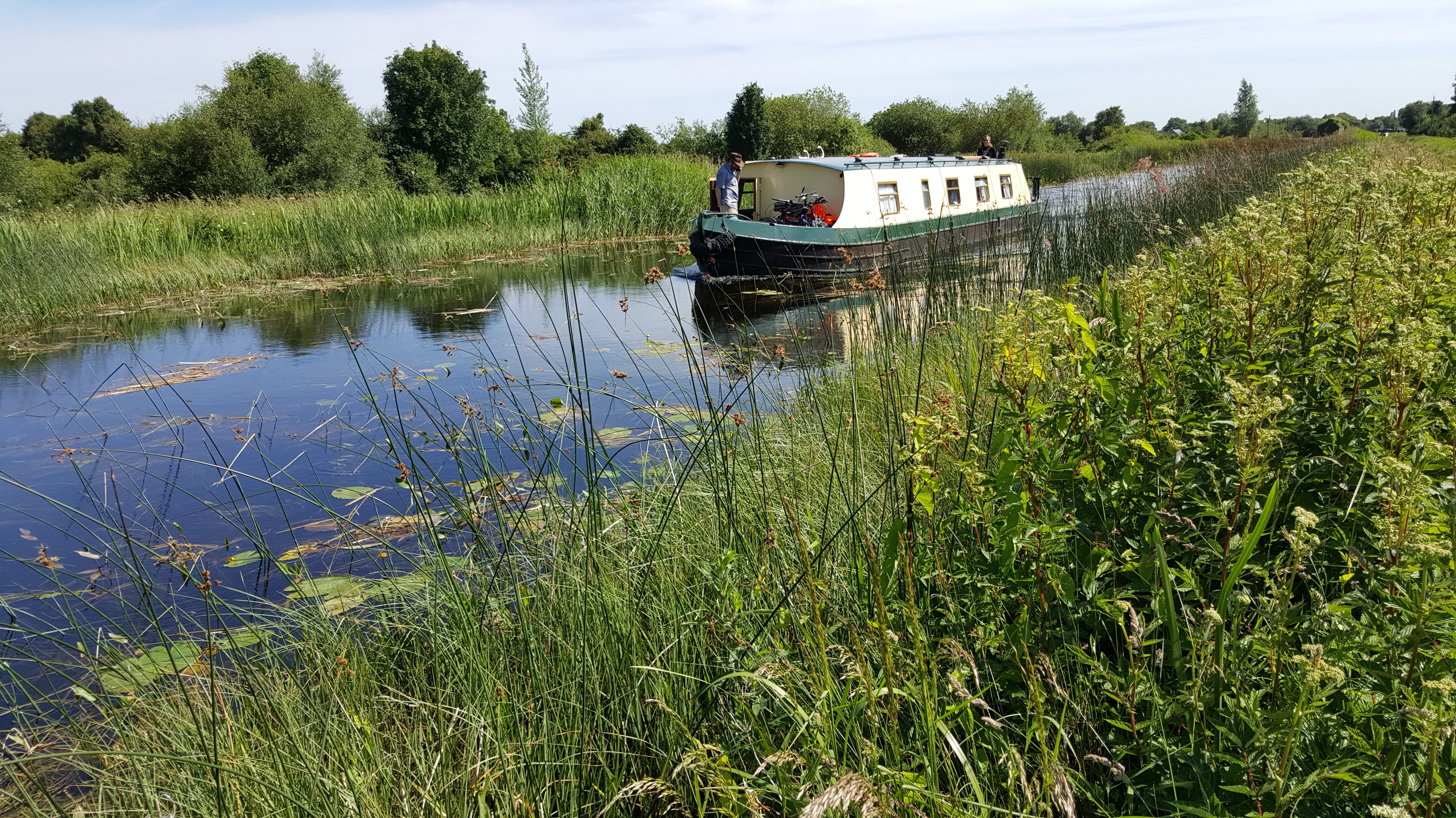
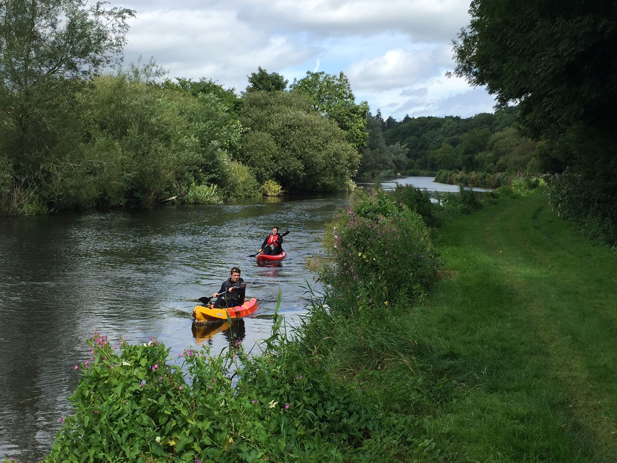
A couple of kilometres south of Clashganny I saw  two freshly emerged comma butterflies basking in the coolish afternoon to capture the maximum of warmth. Comma are now well established along the towpath in the area, yet is always a delight to see them. I also was greatly entertained by watching the queue of boats using the lock gates at Fenniscourt, to navigate up the river. You wouldn’t want to be trying to get anywhere in a hurry!

The Barrow at Graiguenamanagh

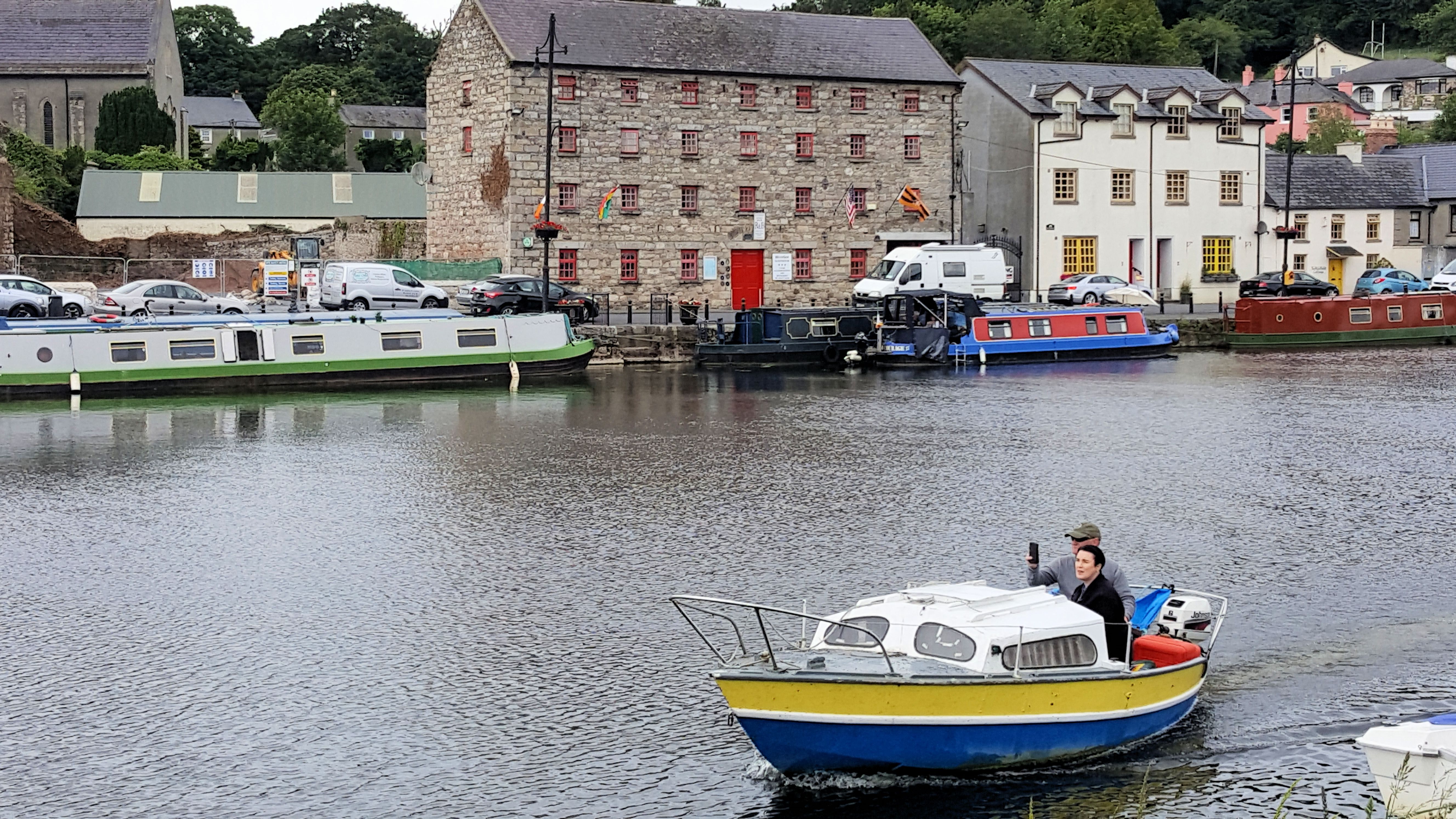
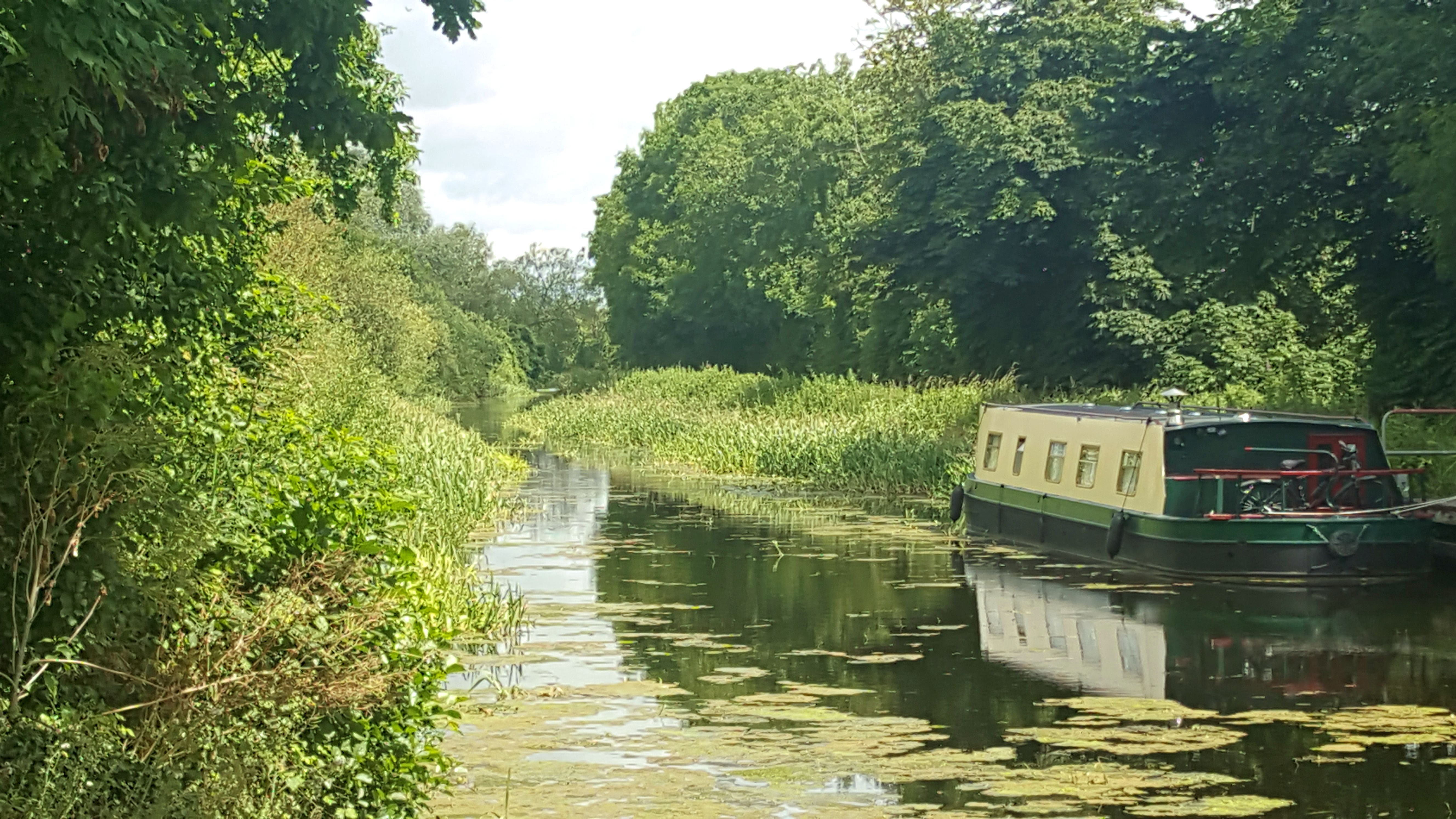
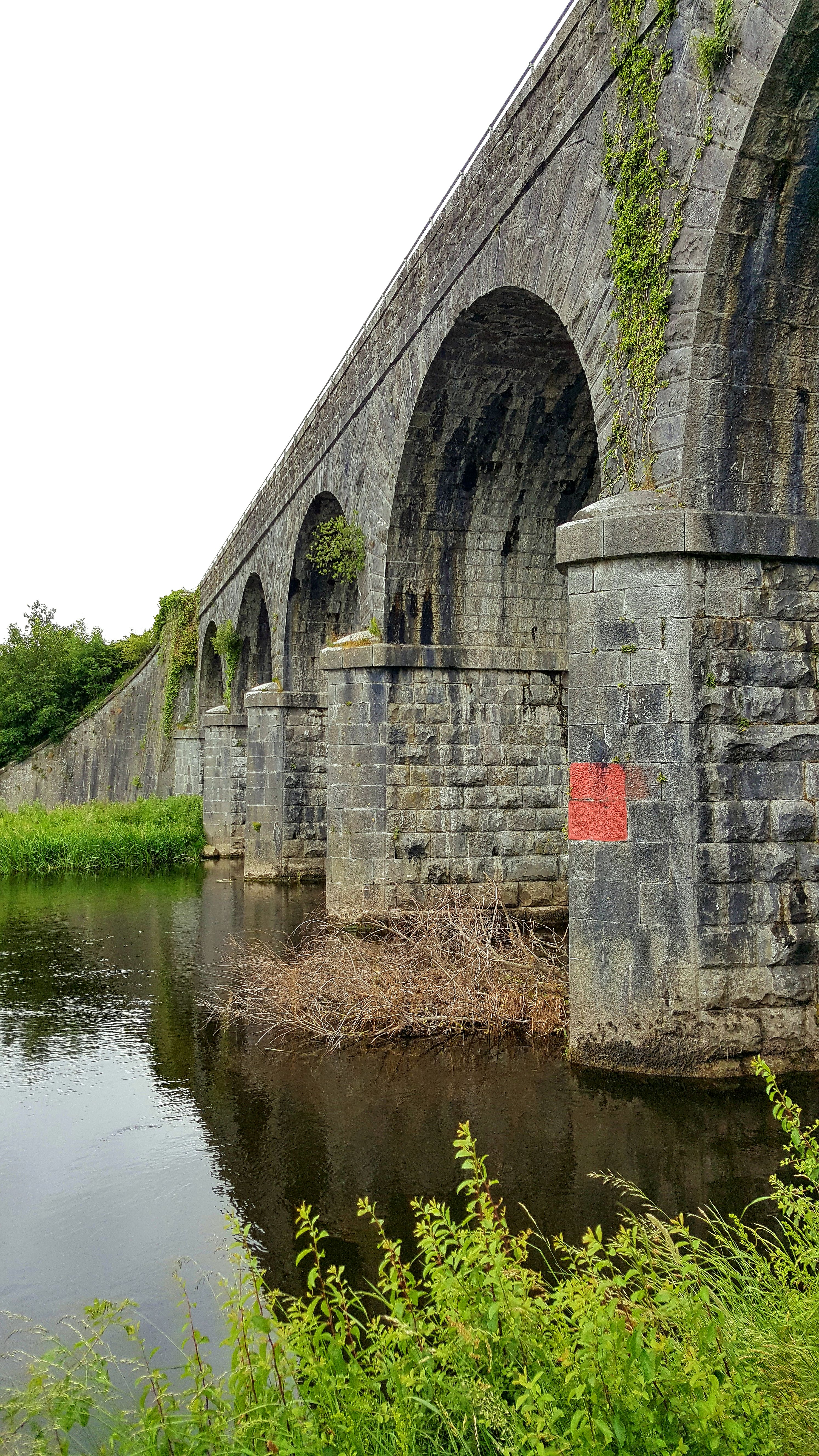
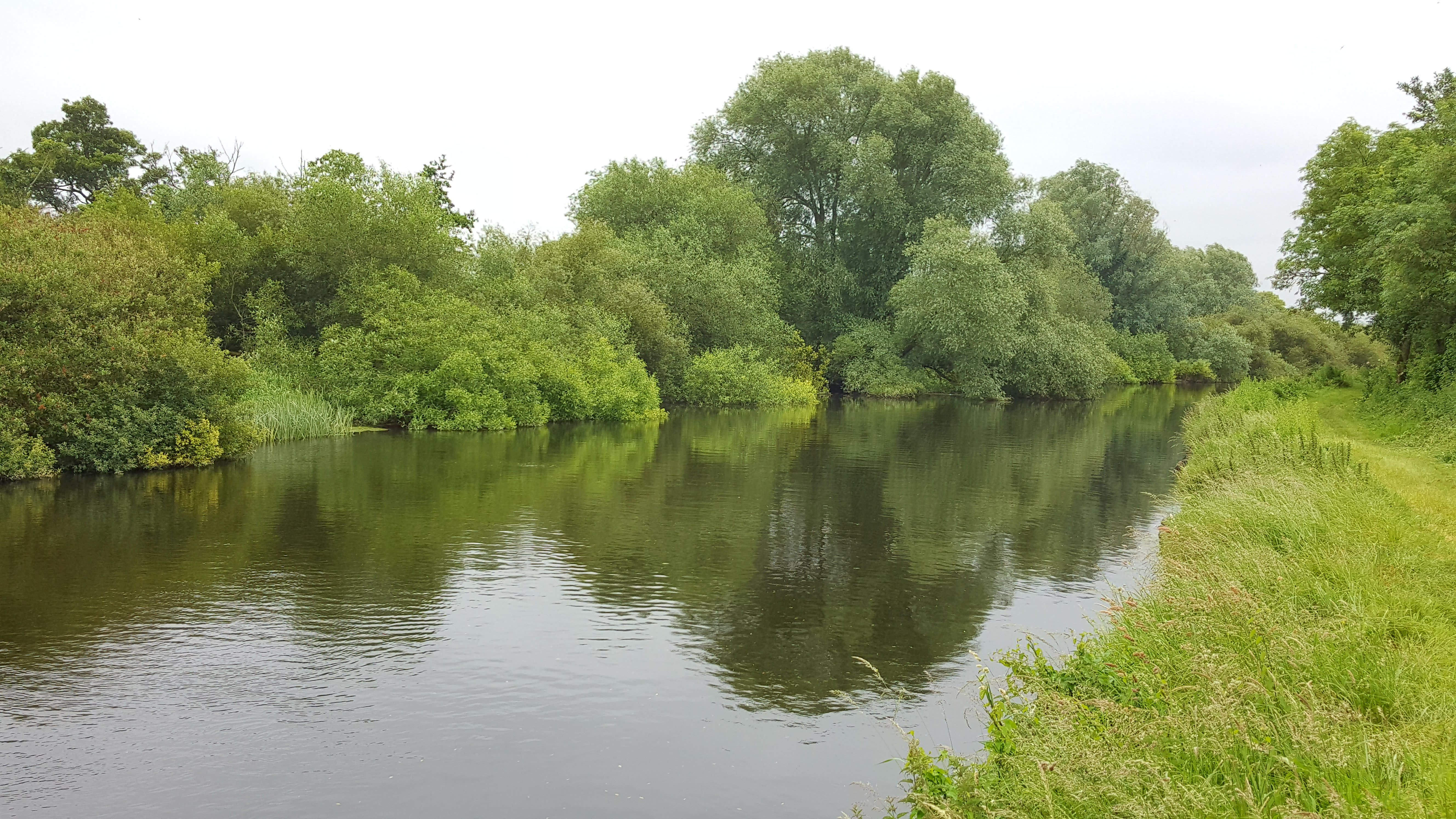
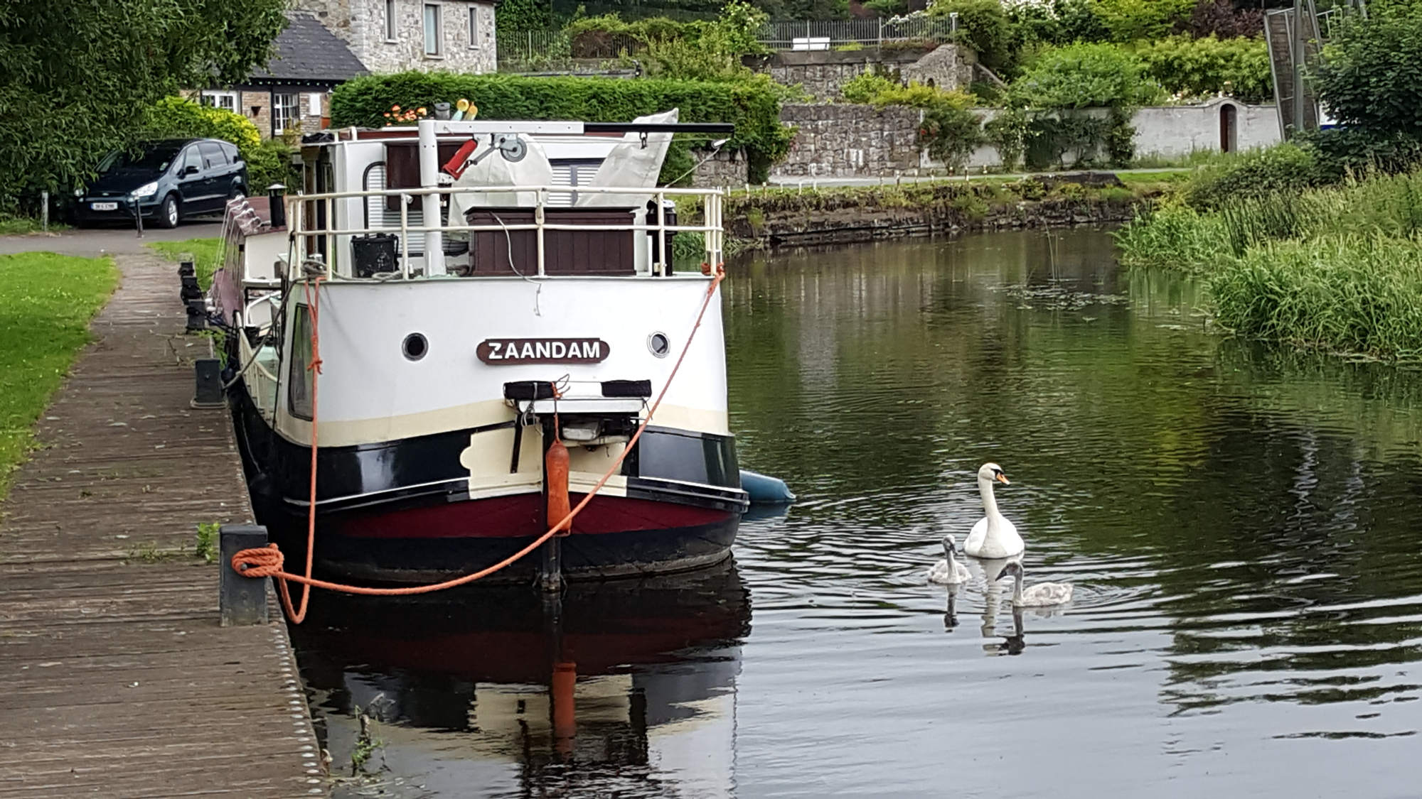
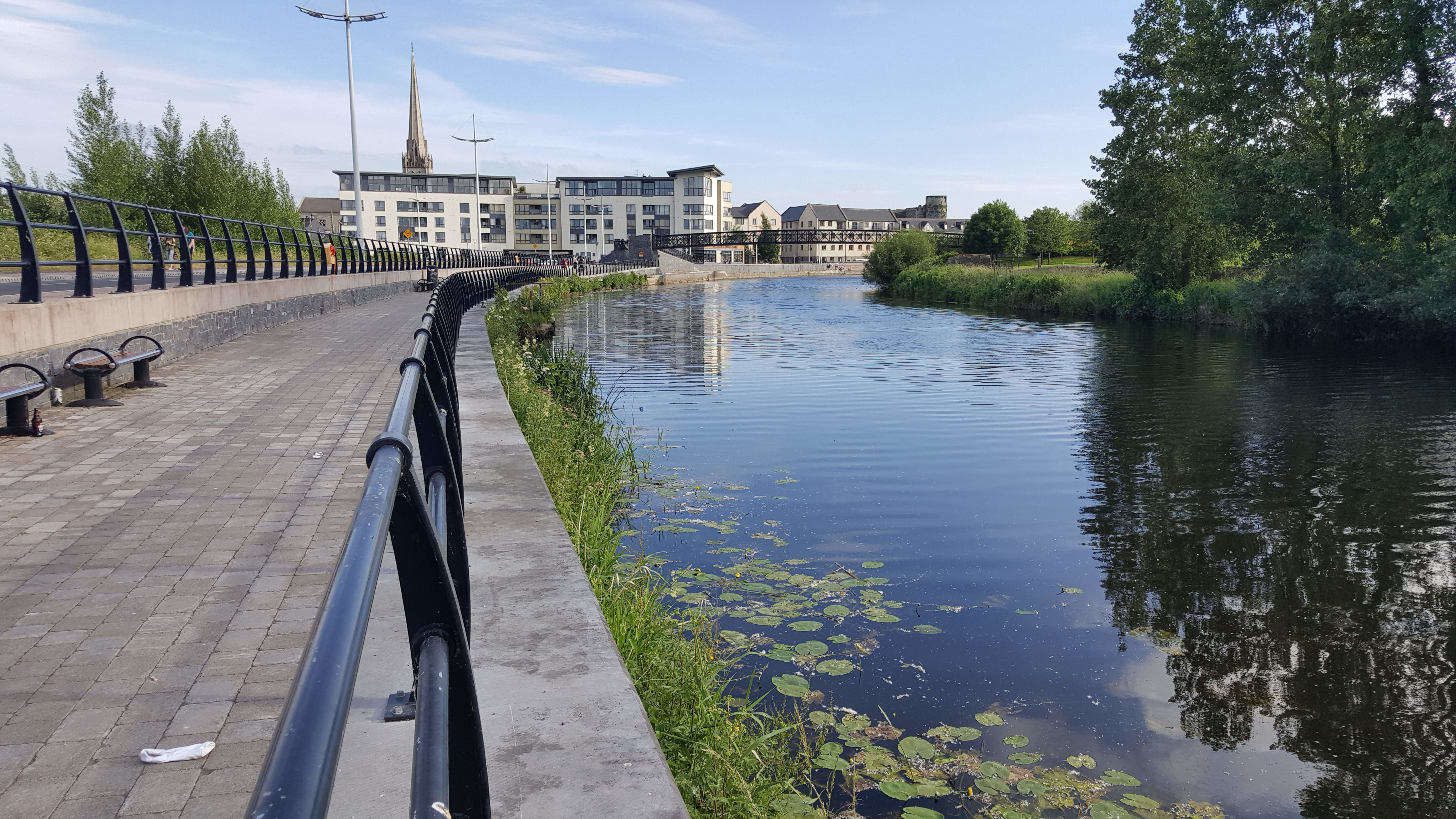
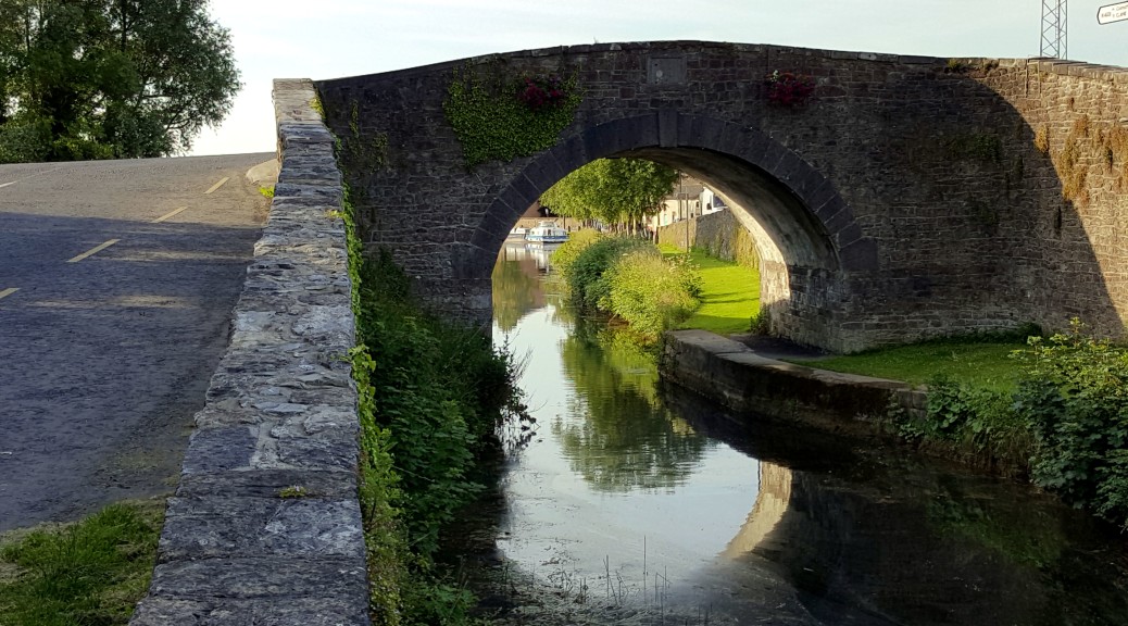
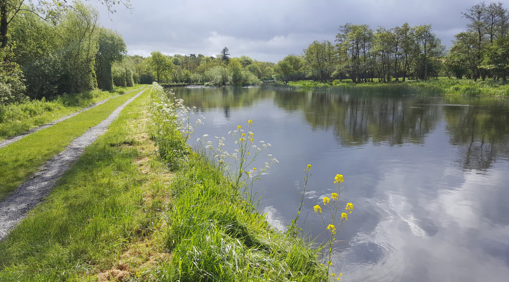
A short walk brought me to the beautiful village of Graiguenamanagh – a really picturesque village which, at first sight, seems to have everything going for it. A beautiful waterfront with plenty of moored boats, impressive façade of the Riverside Guesthouse reflected on the river, a magnificent 7-arch bridge and the backdrop of Brandon Hill makes this special. However, I know this gives a somewhat misleading impression for Graiguenamanagh like other villages in the vicinity is struggling to sustain or expand the local economy.  There can be no doubt but the development of the towpath to accommodate cyclists would provide a huge injection of visitors and revenue for Graiguenamanagh. But the question remains, does this alone justify the radical altering of character of the Barrow Towpath? Or could the aggressive marketing and promotion of walking and other river-based activities also generate the same level of economic development, without destroying the character of the towpath?

Selfie with Josephine and Bella

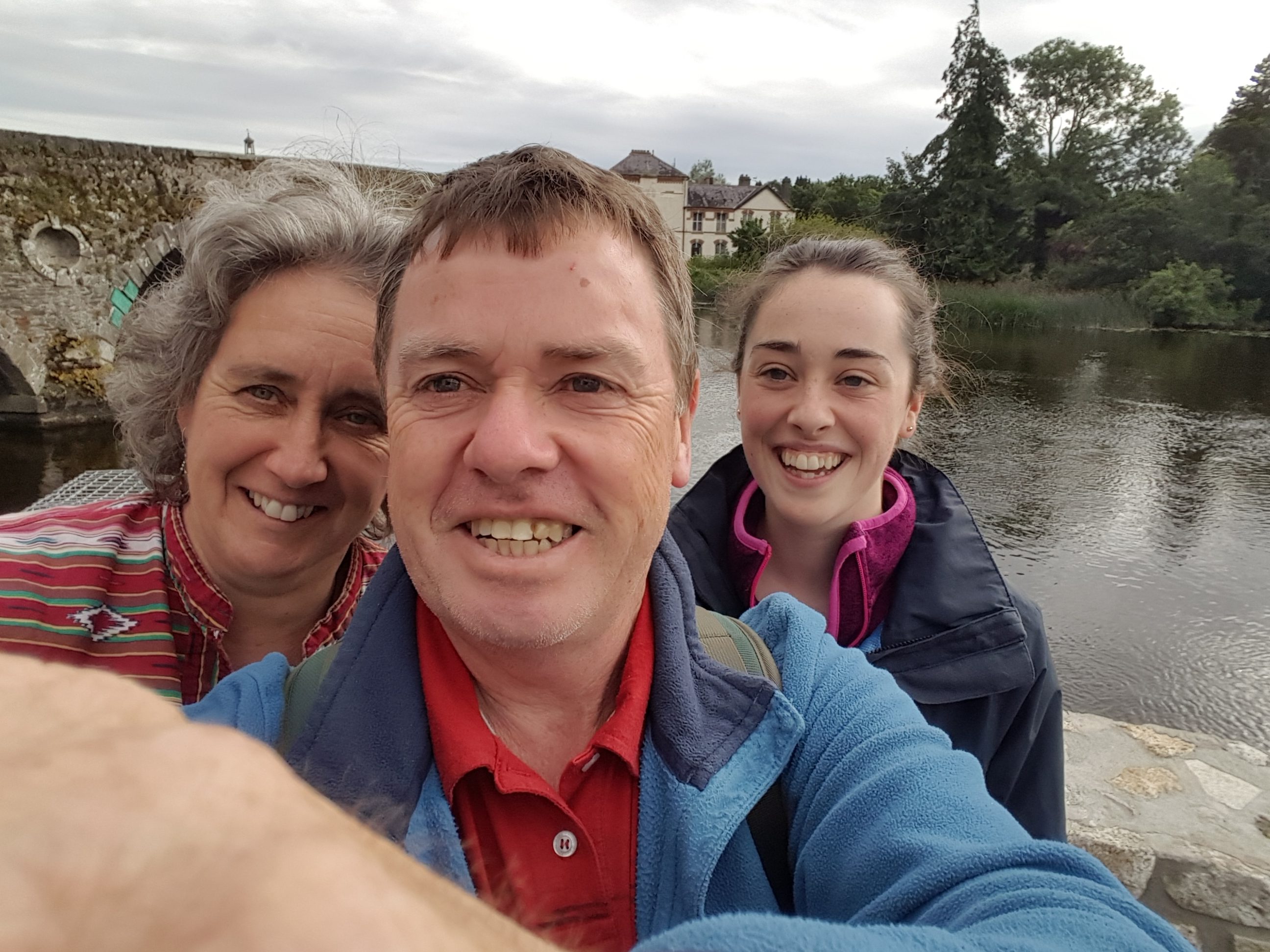
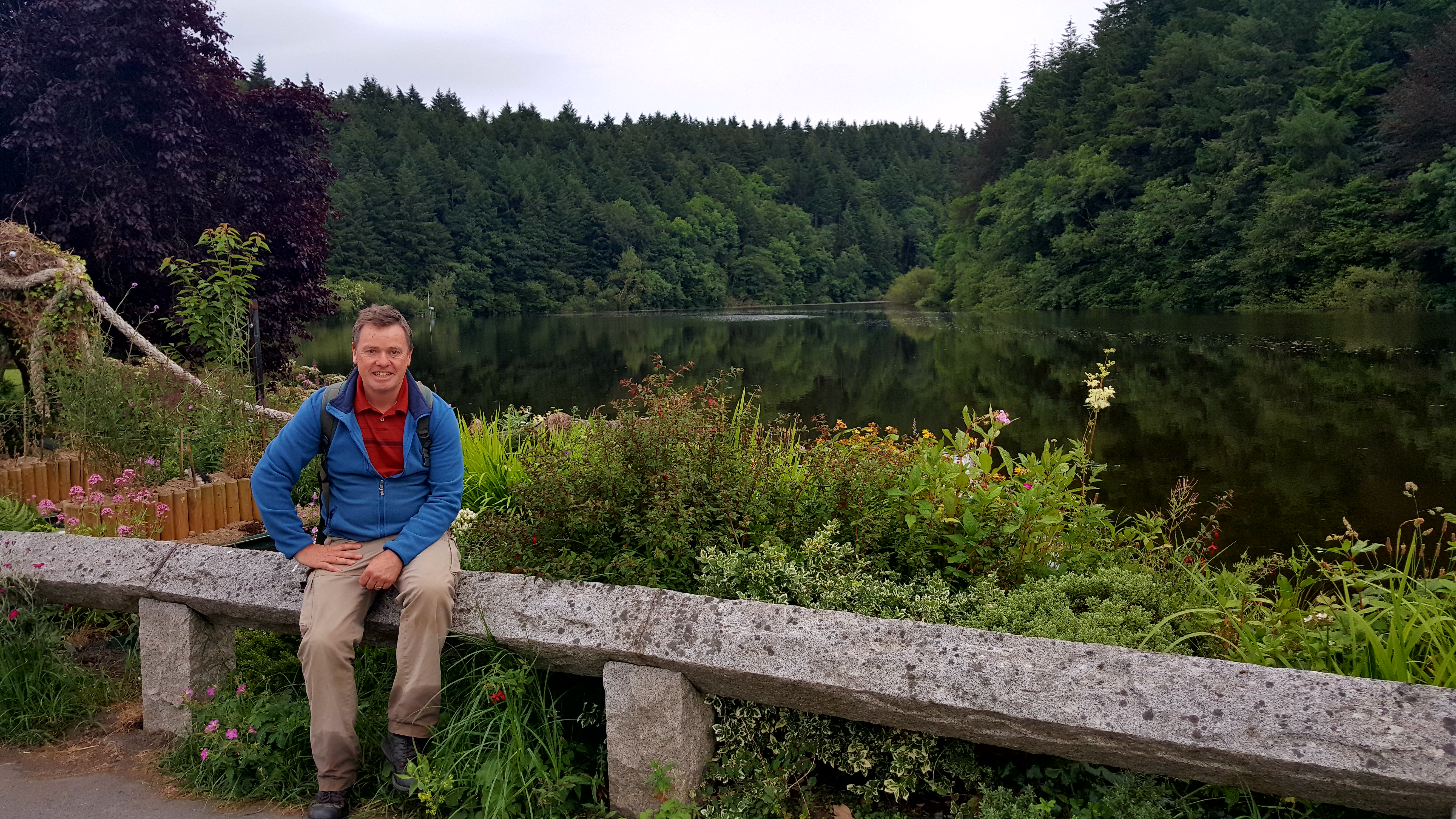
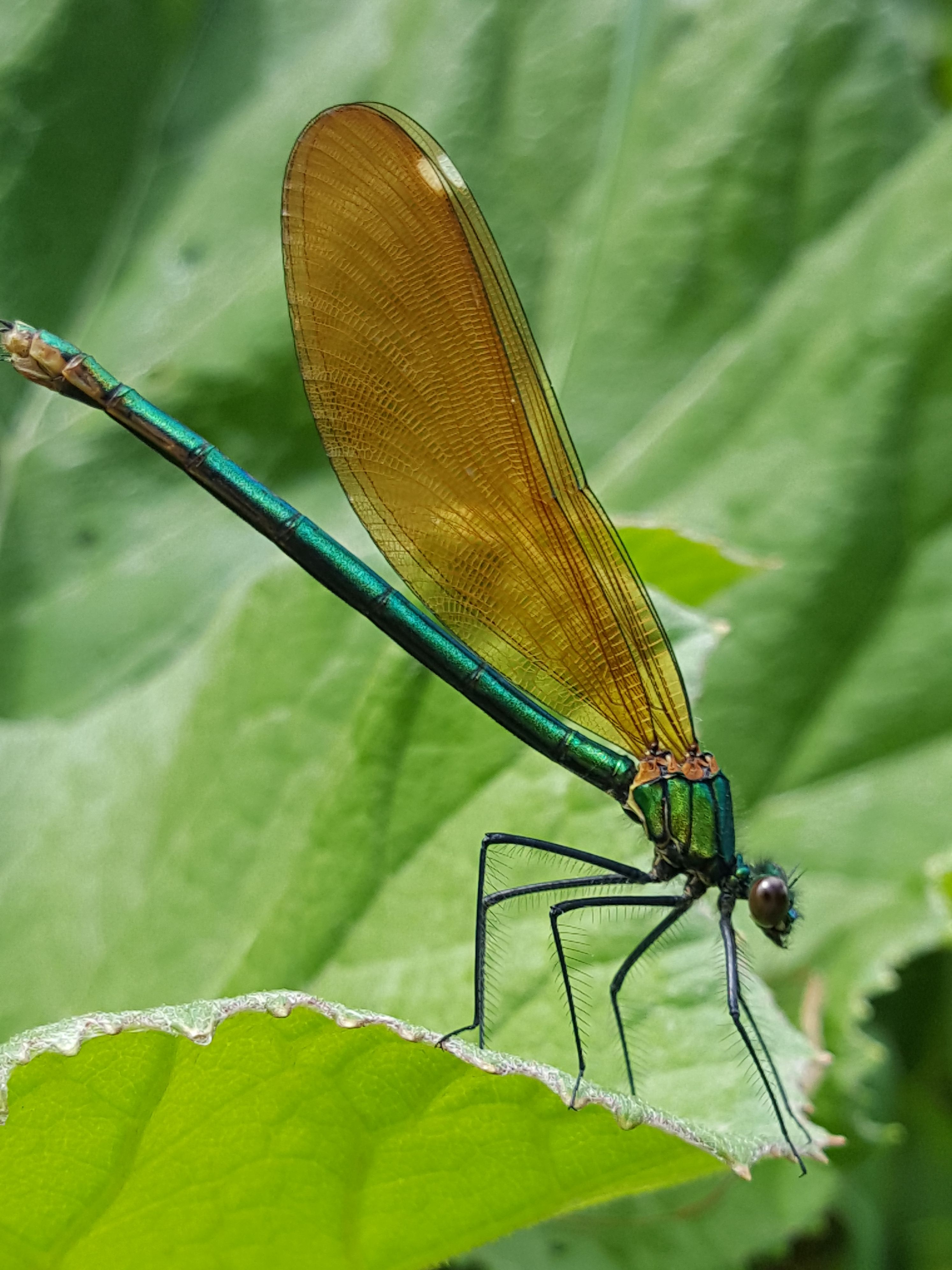
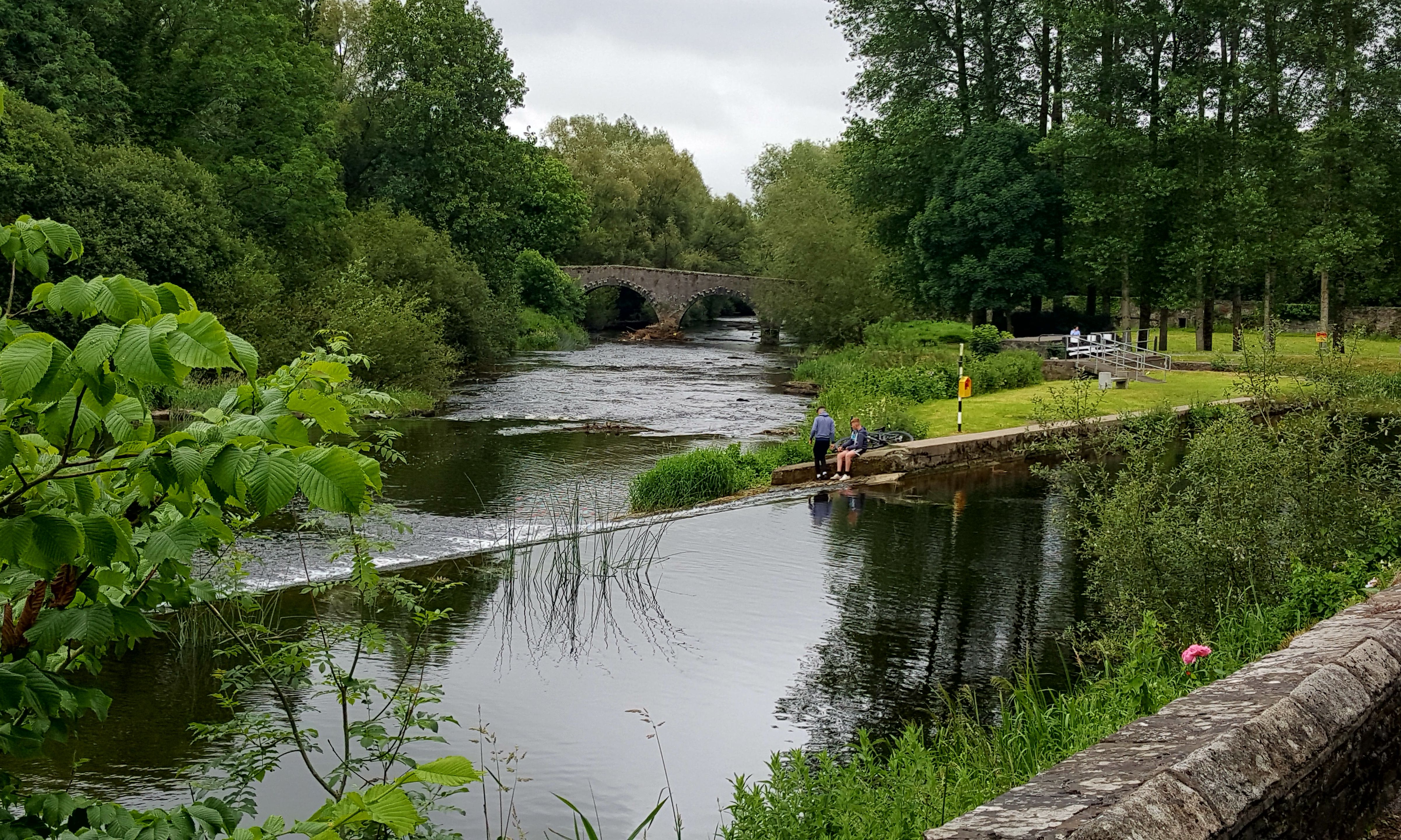
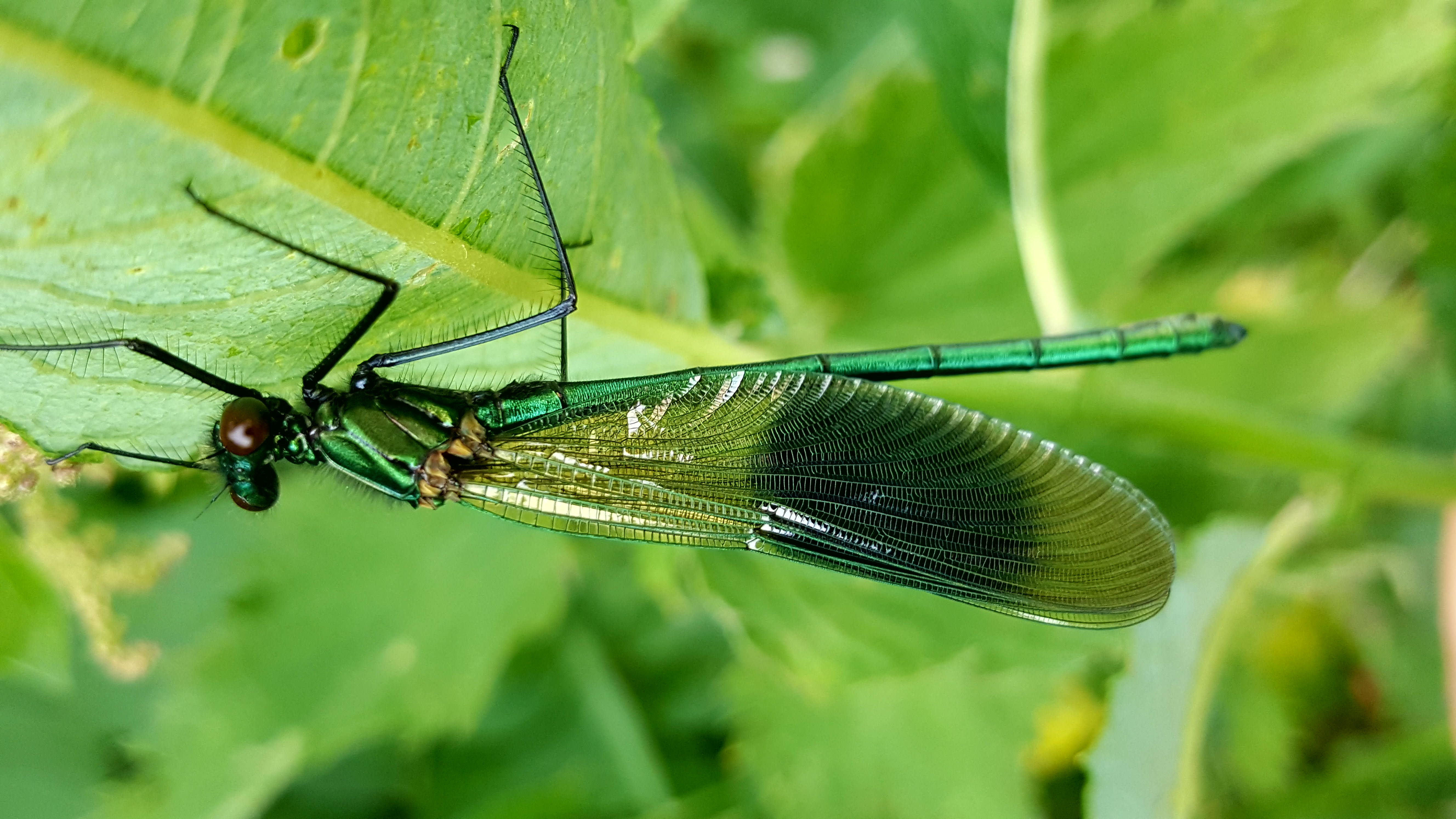
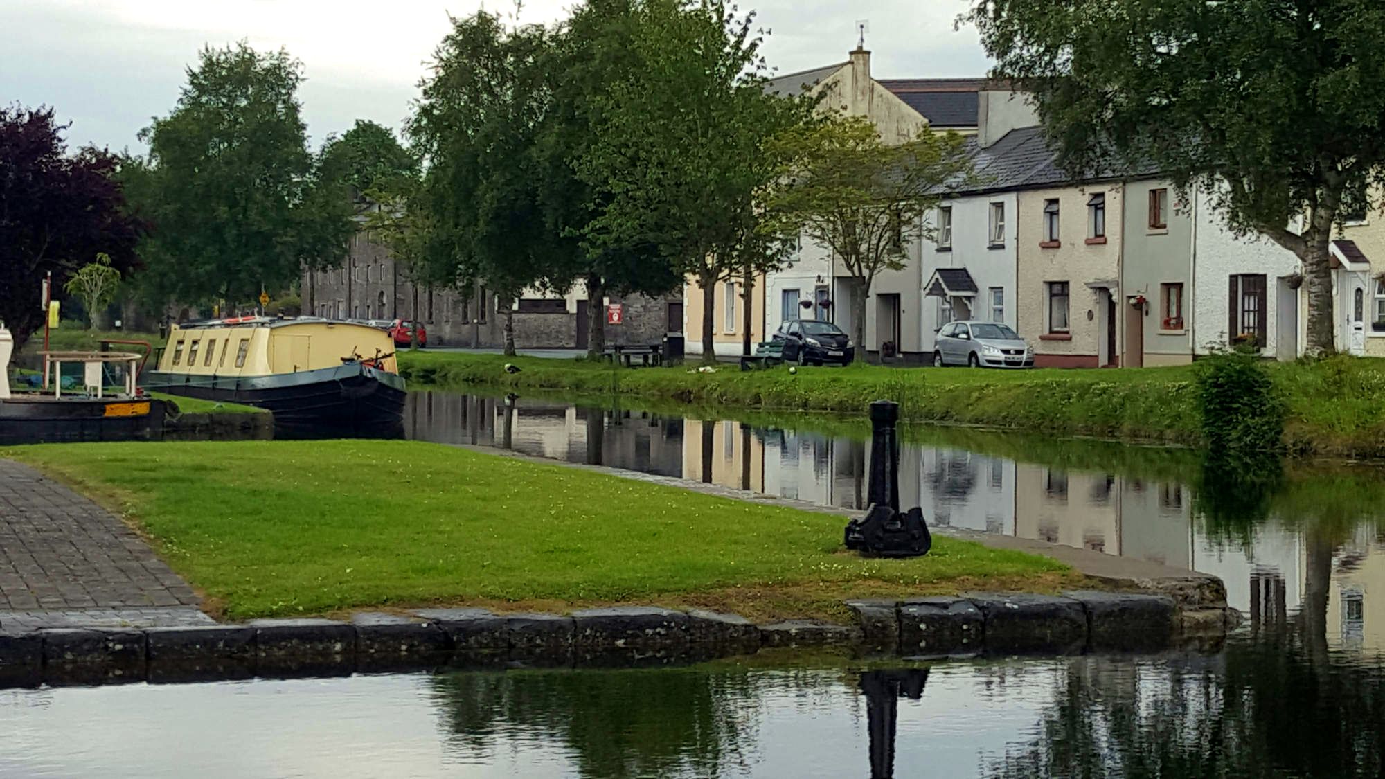
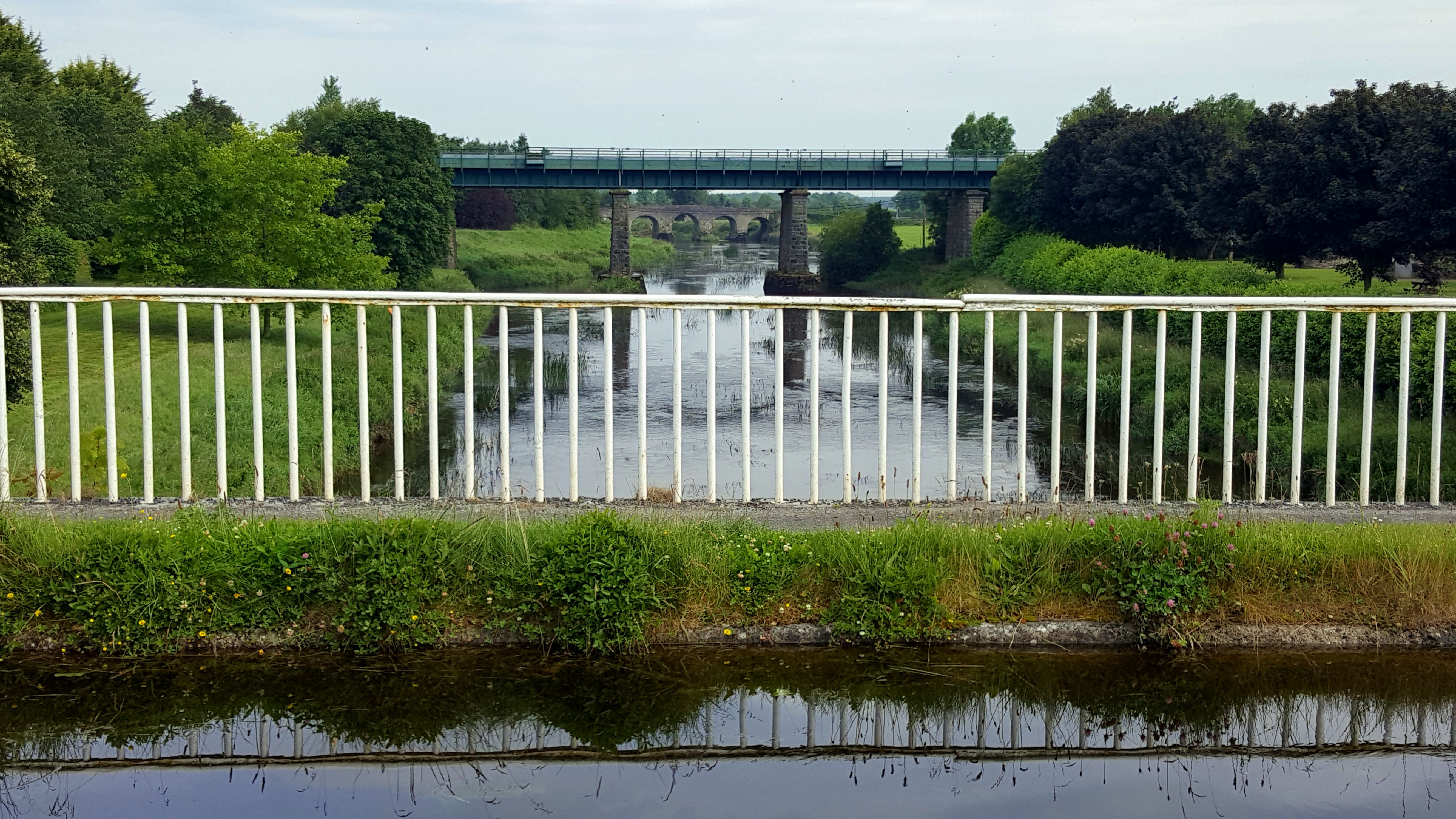
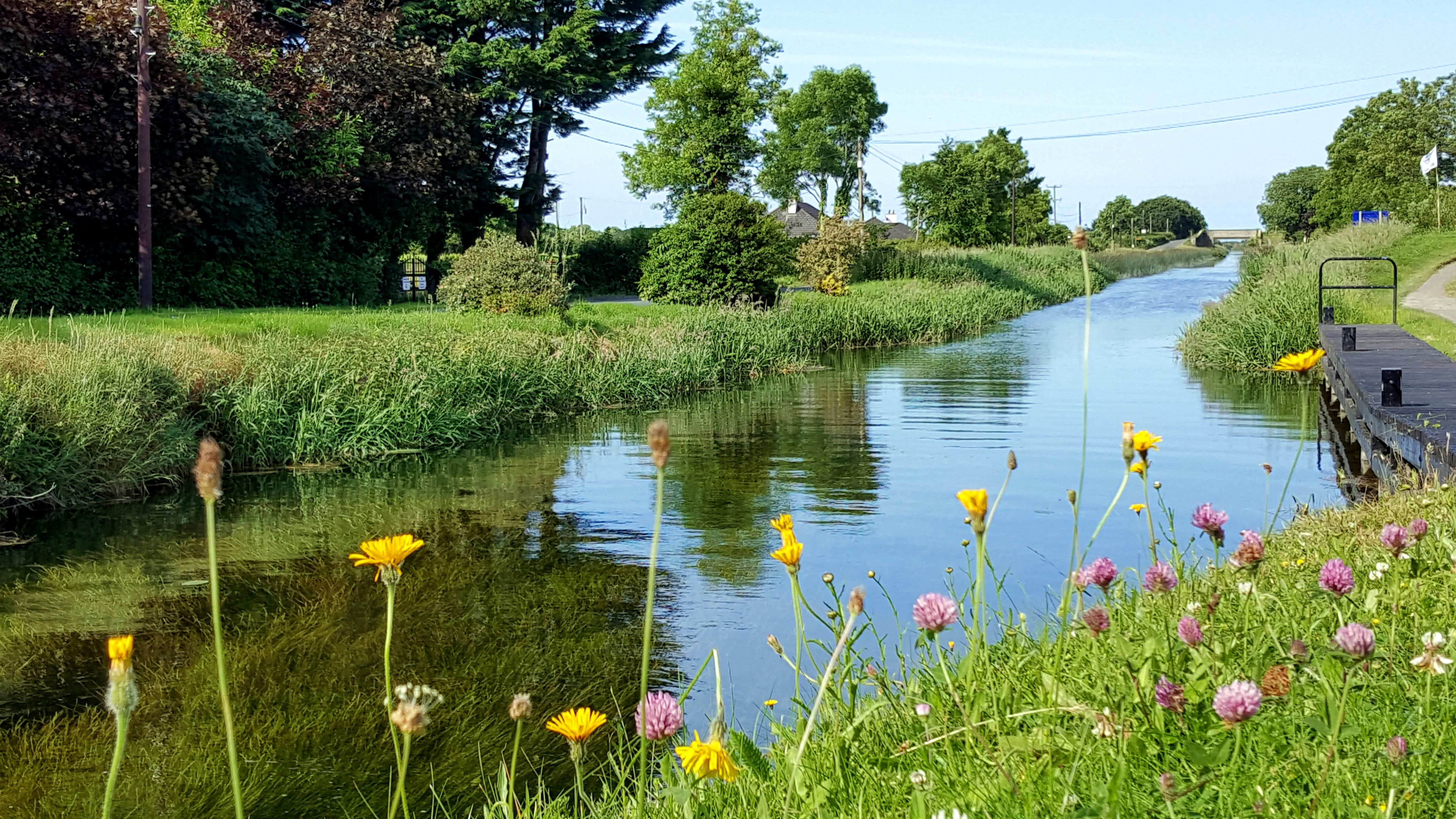
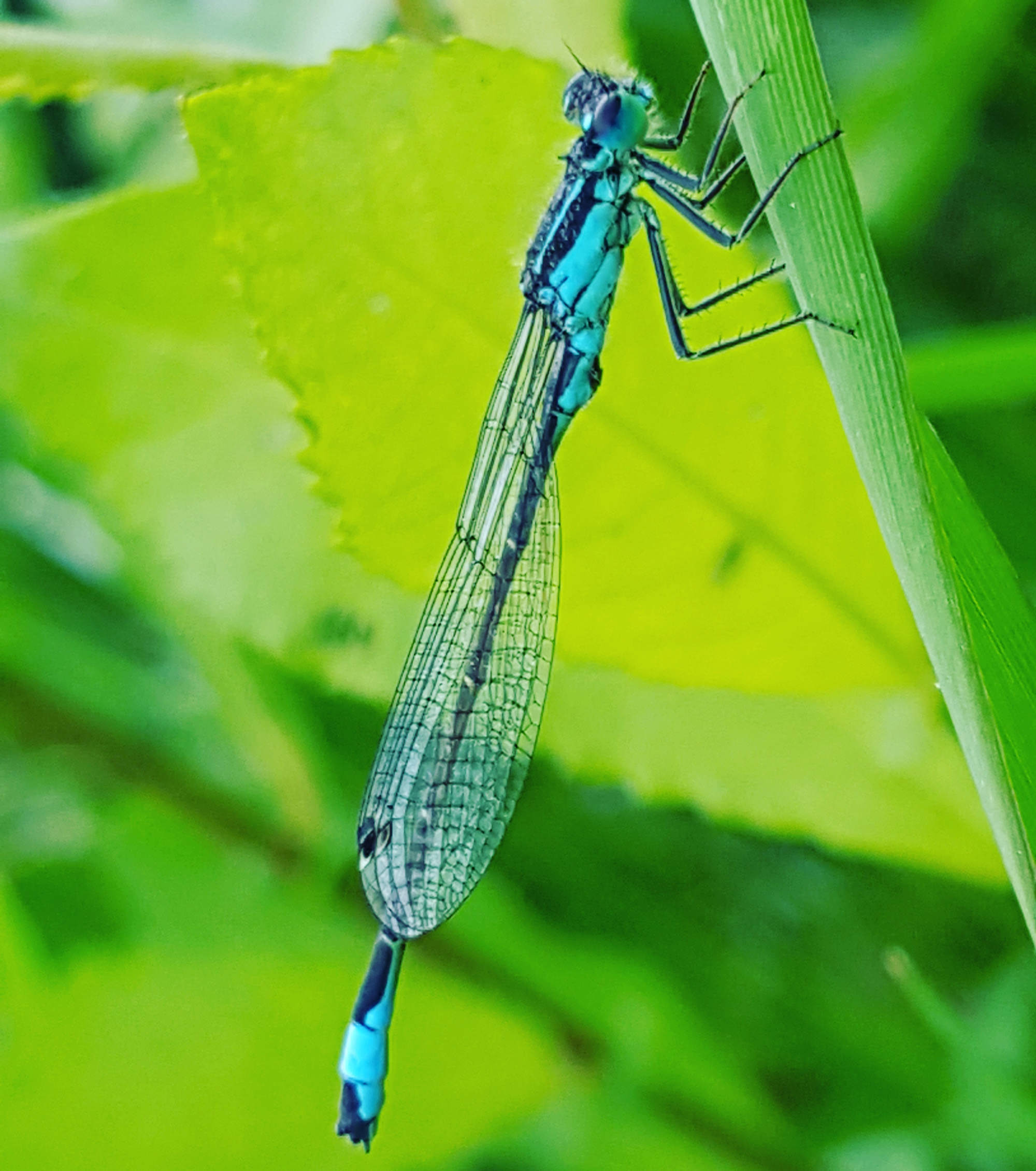
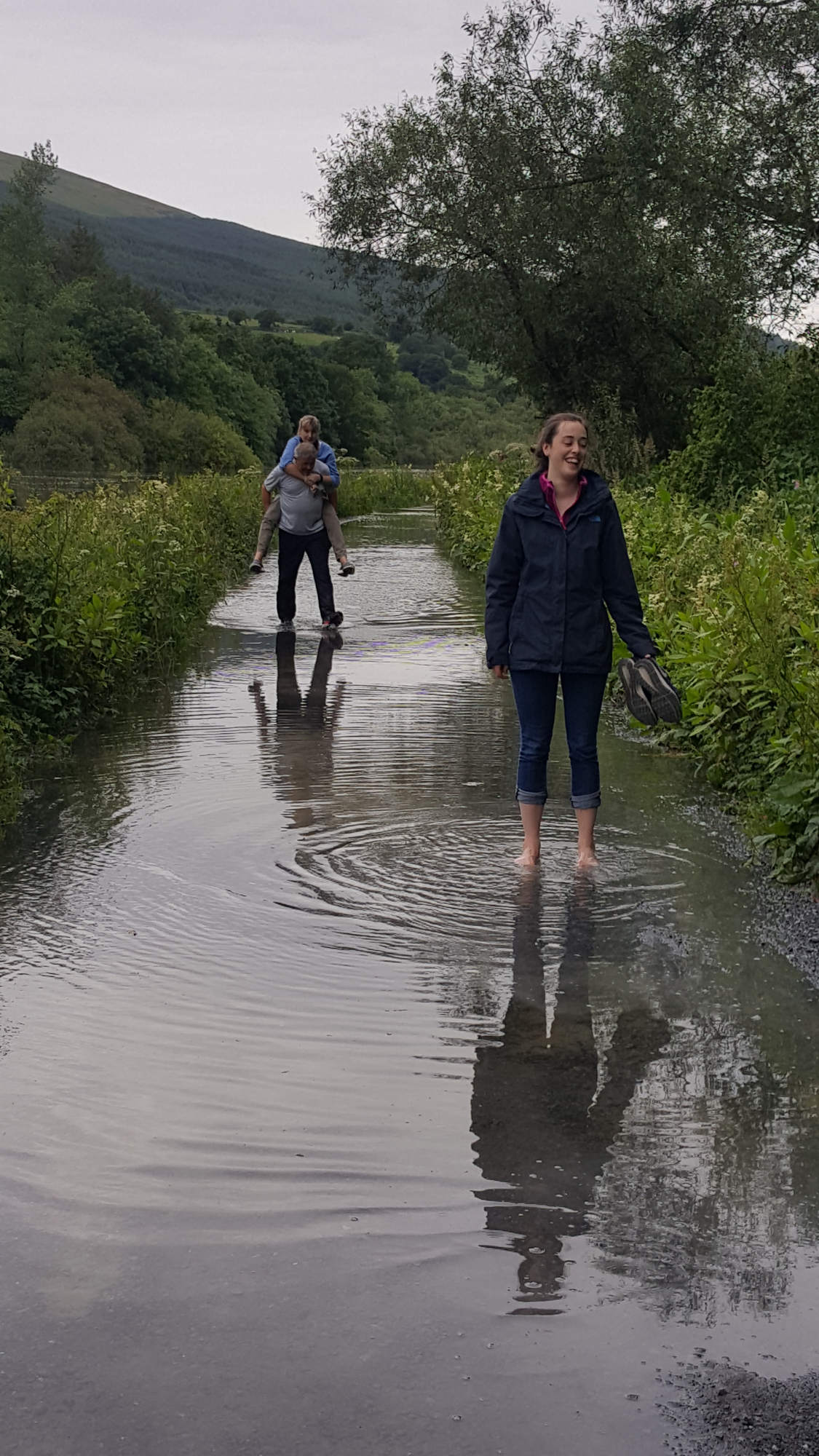
I was delighted to be joined in Graiguenamanagh by my wife Josephine and daughter Bella, for a coffee. Bella wanted to walk with me on the final stretch of the towpath down to St. Mullins, and it was great to have her company. We chatted, stopped to photograph some damselflies and admire some of the beautiful cottages along the river, and when we finally got into our stride, walked far quicker that I was used to – arriving in St. Mullins in no time at all. The river at St. Mullins is tidal, and when we arrived the tide was exceptionally high, so high in fact that we had to wide through water along the very last section of the path getting our feet (and in my case, boots) wet. That I walked over 130km along a waterway and stayed dry, yet managed to get my feet wet in the last kilometer probably has some significance, but if it does, it was lost on me!

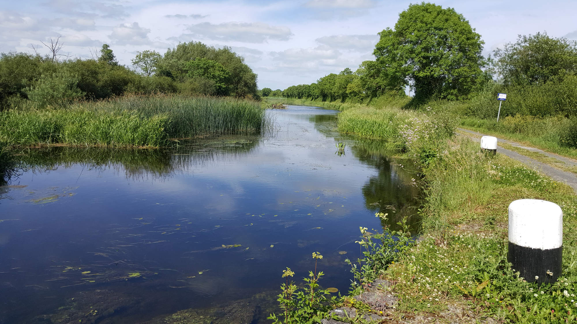
So I spent six wonderful days walking the Barrow Line then the Barrow Towpath, seeing the route at its best in glorious weather. In the six days I covered 133km and traversed a good cross-section of the east of Ireland, through beautiful landscapes rich in heritage, both built and natural. I experienced at first hand the wonderful amenity of the Barrow Track and had plenty of time to think about the merits of the development proposed by Waterways Ireland.

High tide at St. Mullins

There can be no doubt but the Barrow path is a wonderful amenity and one that should be cherished. Investing in it so that the experience of users can be enhanced is a good thing to do, and should be commended and supported. God knows we need more, not less, investment in Ireland’s natural amenities. But that does not mean that any development or investment is automatically a good thing. My personal view is still that the removal of the grass towpath would be a terrible mistake for it is a special amenity and would potentially lead to environmental degradation. However,  I think that a cycleway should be developed as far as Athy, but segregated from walkers by using the existing farm tracks and narrow roads rather than the grass track. The route then from Athy to St. Mullins should be developed and promoted for walking and other river-based activities that would enhance the unique experience of the amenity. Now that would make for a wonderful use of an amenity that could accommodate different interests, without any one use dominating the others.

I really hope that when the merits of the proposed development are being adjudicated upon by decision-makers that the views of all the different sectors are taken seriously, and that the existing non-monetary benefits of the amenity are properly recognised. For if the wrong decision is made, there will be no turning back.

A 133km walk along the Barrow Track – I enjoyed that!

Day 5: Bagenalstown to Clashganny (25km)

20170624_124617
Slyduff, one of the many picturesque lock gates

Today’s walk takes me into familiar territory. I live in Gowran no more than about 6km from the Barrow, so I visit the river often. It is a fantastic amenity to have so close at hand. It is rich in wildlife and I try to make good use of it, as do the family. The walk from Bagenalstown to Clashganny, a distance of 25km, covers perhaps the most beautiful and special part of the Barrow. Along this stretch there are six lock gates in the most magical, peaceful setting, an impressive five-arch railway bridge spanning the river south of Bagenalstown, and beautiful valerian-covered stone arch road bridges at Goresbridge and Ballyteigelea. Sitting under the towering railway bridge watching grey wagtails feeding their young and listening to swifts screaming overhead was a special treat.

20170624_110532
The railway bridge at Bagenalstown

The main river channel is nice and broad but for much of the time the towpath follows narrow channels leading to the lock gates, giving the appearance of a sluggish canal. The still water of the canalised sections interspersed with the fast flowing rapids provide variety to the river structure which in turn supports increased biological diversity.  This is kingfisher territory, so almost every visit is rewarded with a glimpse of these magnificent birds plying the river.

As the river flows south the valley steepens and the slopes become more wooded. South of Ballyteigelea Bridge the river flows past the magnificent deciduous woodland of Borris Demesne. This is my favourite part of the river as it supports many biodiversity treasures. The beautiful scalloped-winged comma, one Ireland’s newest butterfly arrivals, is now commonly seen here. Purple Hairstreak also breed on the canopies of the oak trees along this stretch, but despite my best efforts, I have yet to find them. The garrulous Jays call from the woodland, and most recently Great-spotted Woodpecker have taken up residence here. Today they were silent, but when walking the path last weekend with my brother Seán, he picked out the harsh kik-kik call, a delightful find. I can’t wait to visit next spring to hear the woodland resonate with the sound of their drumming.

20170624_165452
The Barrow River at Borris is a really special place

As it was a Saturday, the river was much busier today. I met many people walking and cycling the towpath, there were fishermen (yes they were all men!) at regular intervals, and saw boats, kayaks and canoes on the river. A group of about half dozen kayakers joined me for lunch at one of the lock gates, and kindly shared their picnic with me. We kept pace with each other for the rest of the day, for although they paddled quicker than I walked, their progress was slowed by hauling out the kayaks at each set of lock gates as they did not wish to run the rapids.

20170624_115954
Along the river there is a great sense of community

Walking the towpath, chatting to people as you go, you get the sense of being part of a community with one thing in common – an affinity for the river. You get the sense that this is their river, and that it means a great deal to them. Unsurprisingly the topic of resurfacing the towpath comes up on even the briefest of chats. What surprised me greatly was that everyone I spoke to, without exception, thought it was a bad idea. I had expected opinion to be mixed on this, but no, everyone gave out about it. What became clear to me is that people who use the towpath are happy with the way it is, but it is those who see potential in exploiting the towpath for business benefit, that want to resurface it.

Beautiful demoiselle
Beautiful Demoiselle

It is very disappointing that this community of users don’t appear to have a voice that is listened to. They don’t ask for much, no grandiose plans, just leaving the amenity as it is. I find it sad (actually it makes me quite angry) that people who appreciate the non-monetary value of special places like the Barrow, have to aggressively fight to hold on to what they have or run the risk of losing it. The exact same issue applies to nature conservation, a topic close to my heart.  Everywhere it seems, is the move toward commodification of wild places; if it doesn’t fall on the right side of the balance sheet, it doesn’t count.

Day 4: Carlow to Bagenalstown (19km)

Carlow resize
Carlow looks different from the river

I know Carlow well as I drive or cycle through here regularly. I have never entered and exited Carlow via the river so this gave me a new fresh perspective on the town. And it is two contrasting perspectives; the northern section with its wonderful new promenade trying to stimulate riverside development and the southern section passing through a rather dreary old industrial backwater. Rivers are an asset to any town, but they require investment to make the most of that asset.

Willows 1 resize
Some magnificent willow grow along the Barrow

Today’s walk took me from Carlow to Bagenalstown, a rather leisurely 19km for which I was grateful as my feet were feeling the effects of the three previous day’s walking. South of Carlow the river runs parallel to the main Carlow to Kilkenny Road and the back road to Milford.  The riverside vegetation is dominated by willow. Willow usually forms scrubby growth but here along the eastern bank of the river, where they are allowed to grow freely, they form tall majestic trees. As I passed them I wondered how old they must be.

After about 8km the river passes through Milford, a lovely picturesque spot. This is a place where locals come to picnic or use as the starting point for a walk along the river. The site is overlooked by the massive Spring Stream Mills, which in 1891 was the source of  electricity to light Carlow, the first inland town in Ireland or Britain that was lighted at the time.  After Milford the river follows a natural floodplain down to Bagenalstown giving views over the lush Carlow landscape.  I often thought that if more of the valley was allow to flood naturally it would have the dual benefit of greatly relieving flooding further downstream while also providing wonderful wet grassland that would be of enormous biodiversity value.

Tyndall resize
John Tyndall – famous Irish scientist

At the beautiful village of Leighlinbridge the local community has erected signs about the heritage and local history of the area which I found really interesting. I had forgotten, for example, that Leighlinbridge was the birthplace of the scientist John Tyndall who was the first to prove the ‘Greenhouse Effect’ of the earth’s atmosphere, a topic that has become central to understanding one of today’s key global crisis. Leighlinbrige is a place you could linger for there are points of interest to explore because the local community takes pride in showing off what they have. Like the Black Castle which guarded the strategically important crossing of the Barrow in the 12th Century about which, much to my shame, I knew nothing. This contrasted starkly with the attitude of Waterways Ireland to presenting the wonderful Barrow to visitors using that facility.

As I noted already, not a sign or information board could I find about any aspect of the canal and towpath – signs galore telling me that I can’t swim, trespass, park or bring my horse – but not one to welcome me, to tell me about the route I am exploring, or even providing me with a simple bench to rest my weary feet for a while. Only now has Waterways Ireland appeared to have woken up to the fact that they are custodians of the waterway as a public space, and have moved into overdrive anxious not just to get the basics right, but to provide an amenity for everyone (a multi-activity amenity) and solving the economic development problems for the region in one fell swoop. Going from having difficulty in delivering on basic management and core roles to grandiose plans for change is an age-old symptom of public bodies, a symptom I experienced at first hand when I worked for the Office of Public Works with its plans for building a magnificent Interpretative Centre at Mullaghmore in the Burren. For bodies such as these, it is an ‘all or nothing’ management strategy. It should be said,  this is not a good management strategy.

Milford cropped
Milford is a beautifully scenic spot on the Barrow

Day 3: Athy to Carlow (21km)

Athy 2 resized
The River Barrow below Athy

The final stretch of the Barrow Line flows through Athy, past an industrial area, which is a reminder of the original reason for the canal spur off the Grand Canal.   Then just south of Athy, at a confluence with some nice stone bridges, the narrow canal joins the wider, more natural flow of the Barrow River. This is the river I am more familiar with, and that I propose to follow down to St. Mullins.

20170622_115711
Banded Demoiselle

The Barrow River flows slowly along a gentle valley and for much of the route to Carlow, scrub and woodland provide a corridor for the towpath. In places, tall willows and alder provide a wonderful backdrop to the river and a very important habitat for wildlife. The river was alive with damselflies and demoiselles. At intervals there are old small stone bridges that span narrow channels allowing access for livestock to the larger islands on the river, but many are now is a state of disrepair. On the other hand, the bridge at Maganey is an impressive structure. The towpath surface between Athy and Carlow is mostly grass but some sections have a hard surface. Nevertheless, all of it made for pleasant walking.

20170622_163548
The Barrow at Maganey

I met many more people walking or fishing along the towpath than I had over the two previous days. I made it a point of speaking to some of them about the proposed resurfacing of the towpath and all said, without hesitation, that it was a bad idea and would destroy the place. They talked about how they loved coming to the river, to walk or to fish, as there were few places like this around about. No one I spoke to said it was a good idea. So why is Waterways Ireland not listening to these opinions? Do the views and needs of the existing users of the amenity count for so little that Waterways Ireland feel it is ok to ignore them?

The Barrow Towpath differs from the Barrow Line in that you are much closer to the hustle and bustle of daily life. Much of the towpath runs close to roads, but obscured from them by the woodland corridor. Hearing the noise of passing traffic in the background does little to detract from the peace of the river walk; if anything it adds to it as it makes you appreciate what you are escaping from.  And on the approach to Carlow, it was wonderful to see so many people out walking and running, and the river being used by the local rowing club. And right in the town centre there is a big new development of a promenade to bring the community back in touch with the river. To me, this is the kind of appropriate development that this amenity requires, rather than obliterating the peace and tranquility already enjoyed by people away from built up areas.

promonade resize
The new promenade at Carlow

Day 2: Monasterevin to Athy (28km)

Monasterevin1 enhanced
The Barrow Line runs through Monasterevin

In its heyday, the canal would have served as an economic artery for Monasterevin, but those days are long gone, and the town has turned its back on the canal. The industrial heritage of those bygone days is still in evidence in the town. The view northward from the aqueduct with the railway line and the Portarlington Road aligned bridging the River Barrow is a spectacular showcase of civil engineering.

After Monasterevin3
The aqueduct, railway bridge and road bridge aligned

The walk from Monasterevin initially followed a lovely sunny bank on the right, festooned with deep pink pyramidal orchids and spotted orchids of different hues of white and pink. Butterflies basking in the warmth of the bank, bees and hoverflies busily going about the business of pollination. And all the bare patches of earth were pockmarked with small holes, tell-tale signs that it is also home to solitary bees.  Passing under the M7 motorway was a strange experience with the traffic hurtling past; together in the same place yet worlds apart. But from here to Athy, a distance of maybe 18km, it was just me, my thoughts and nature, a rare experience these days. What is special about this place is the path was a wide wonderful carpet of mown grass, beautiful to walk on which made covering the distance enjoyable. That any organisation would seek to rid the area of this asset is absurd.

orchid resize
Pyramidal orchid

Having said that, I was struck, yet again, how little use is made of the canal and twopath. Over the course of four or five hours I met two fishermen, one woman walking her dog and a father and son paddling a canoe. It is ludicrous that the canal and towpath gets such little use, and I can understand why businesses would like to build a cycleway along the canal to generate tourism revenue for an area that could badly do with an injection of commerce; towns like Rathangan, Monasterevin and Athy would certainly benefit from more visitors.  But planning to sweep away what is already there and replacing it with a surface more suitable for cycling means rather than encouraging multi-use of the amenity, priority is given to one group of users over others. And, while I greatly enjoy ambling along the towpath, looking at wildlife, I know that if the towpath was resurfaced and I arrived here on my bike, I would head off at a different pace eager to cover the miles as quickly as I could, spoiling the experience for others.

But I did notice that for almost the entire distance from Lowtown to Athy, a road or farm track runs either side of the canal. Why not retain the grassy towpath for walkers, but develop the other side as a cycling path, thereby segregating the users? It would require the agreement of the local community, and probably giving cyclists the right of way along some sections of narrow local roads, but the benefits would be enormous. Having a cycle route from Dublin to Athy would be a great amenity that could help rejuvenate the area. And while this might be a compromise proposal, I certainly wouldn’t support the plan to construct a cycle path along the Barrow River, south of Athy.

image for day 2
Having a grassy path like is amazing – planning to remove it is madness

Day 1: Lowtown to Monasterevin (27.5 km)

Lock 19
Lock Gate 19 (old), the first lock gates on the Old Barrow Line

This is new country for me. I may have passed through here by car on occasions but I have never stopped to explore. So a new experience awaited me. A short walk took me to Fenton Bridge, where the Old Barrow Line leaves the Grand Canal. A local I spoke with called it The Summit, as it is the canal’s highest point – it is all downstream from here. Fenton Bridge gave me a bit of a feel for life on the river, for there are a few lived-in barges moored here, but only a few.

The next few kilometers took me along country tracks, and a rather gentle introduction to the experience that lay ahead. Beyond Ballyteige the canal became elevated and provided nice views over the surrounding countryside, with the Hill of Allen off to the south. I could not see the bog of Allen to the north, but the few tractors hauling turf was proof enough. The Griffith Aqueduct, carrying the canal over a river below, was fairly cool.

new blue
Blue-tailed damselfly

Walking the tow path is an unusual experience. The slow flowing water and the long straight stretches, away from the hustle and bustle of traffic and houses, lulls you into a gentle mood in keeping with the landscape. As the kilometers unfold the changes in the landscape are not dramatic. Instead, they are subtle; stretches where the view is constrained by tall reeds and sedges but alive with common and blue-tailed damselflies, banded-demoiselle and four-spotted chasers, giving way to sunny banks carpeted with bird’s-foot trefoil and spotted orchids, alive with common blue butterflies and six-spotted burnet moths. There is hardly a stretch of the canal without the scratchy energetic song of the sedge warbler or the metallic ring of the reed buntings in the background – two sounds that I don’t hear near where I live.

path surface
How anyone could think this is a good idea is beyond me.

The issue of the surface of the proposed Barrow Track was brought home to me very starkly, in a way I didn’t expect.  Having walked for maybe four hours along the beautiful soft grass track with lovely wildflower bedecked banks, my feet were tiring. Then as I approached Rathdangan the track suddenly changed to sterile limestone chipping; frankly, awful to look at, awful to walk on, and totally out of keeping with the character of the Track.  How anyone could think this is a good idea is beyond me.

It surprised me that I met so few people along the route. One barge, two men walking dogs, a fisherman with his bored wife and a women looking for a secluded place for a spot of private sunbathing (clearly unsuccessfully on this occasion!) were all I met. I began to question why so few people were using this wonderful amenity, on such a lovely day.  Certainly, one reason was that from my perspective, there was no evidence of any effort made to promote the Barrow Way. With the exception of a rather jaded (and damaged) sign about wildflowers of the canal, there was no effort to promote the canal. Nothing to tell walkers about the canal’s natural or cultural heritage, indeed even it’s industrial heritage. I saw no amenity provided for fishing, swimming or kayaking; and even cyclists would have to navigate the many locked gates along the track. Perhaps before trying to change the character of the Track by developing a cyclist’s rat run, some effort could me made to promote the canal walk as it is currently. At the very least the communities that live along the canal, and who could benefit from it, deserve that.

20170620_104655
The only boat I saw on the canal today

An amble by the Barrow

33323707110_3cf10a4ec0_k
The River Barrow at Clashganny, Co. Carlow

Some of you are aware there is a bit of a controversy brewing about Waterways Ireland’s proposal to develop a ‘blueway’ – ‘a multi-activity recreational trail‘ –  along 112km of the old towpath of the Barrow River. The existing towpath already provides a wonderful amenity, al beit an underutilised one, that many people enjoy because of  its natural heritage, beautiful setting and special tranquility. I feel so strongly about the proposal that I have lodged an objection to the planning application, the first time I have ever objected to a planning application.  I have lodged an objection not because I am anti-development but because I feel that if a decision is made to develop a cycling path (and let’s face it, this is the crux of the proposal) it will radically alter the character of the amenity and will spoil the experience for other users. My contention is that the current proposal does not adequately appreciate exactly how special and unique the Barrow Track is, and that any proposed development of the Track should focus on actively promoting walking and ‘multi-use amenity’, but excluding bicycles. The physical works necessary to accommodate cycling, and the activity itself, would be injurious to the environment and to the experience of other users of the amenity.

28818747766_35af6fad08_k
Enjoying the Barrow by kayak.

To this end, I am going to spend this week walking the Barrow Track to experience fully what the amenity offers  as it currently is, and to attempt to share with you why I feel it is so unique and special. I will be sharing photographs and posting blogs about the experience over the week, so please follow me on this blog or on #BarrowWalk. Must remember to pack the sunblock!